Tuesday, December 6, 2011

The Rest of the Story

Well, the rains came.  Once started, they didn’t stop all night last night.  Today, we’ve had sprinkles off and on, but mostly just a dreary day.  Late this afternoon, it started raining again and, if we can believe the forecast, will rain all night and throughout tomorrow.  It’s cold, too.
Found this on one of our hikes this week.

The rain has given us the opportunity to stay inside and get some real work done.  Gene had computer maintenance to do and kept himself occupied while I did the laundry.  Right after lunch we got out and got our errands done before the next round of heavy rain started.  We buzzed through Wal-mart, Lowes, and Hobby Lobby and were back at home within a couple hours.
This hawk hangs our on this utility pole next door.  We see him nearly every day.

We haven’t just been hiking since we got here, although that’s pretty much how it seems.  I’ve decorated our humble abode with the few Christmas decorations I have.  Like last year, I stopped in Hobby Lobby and picked up one of the smallest trees they have.  It’s about 2 feet tall and sits perfectly on the large shelf we have over the cab.  I put on one strand of lights and about 40 miniature ornaments.  Even has a star on top.  So far, Peanut has left it alone.  There’s no storage space to keep it, of course, so after Christmas I’ll give it away.  I think Kayley may have last year’s tree in her room this year.

Peanut got in some big trouble his first Christmas.  We were living in the Montana 5th wheel then and I put up a small tree, maybe 4 feet.  We came home one afternoon from work and found the tree toppled over, ornaments everywhere, and Peanut in the middle of the tree.  After that we did things a little differently when it came to Christmas decorations.
We decorated the garland above the slides; well out of the reach of a certain CAT.

I continue to enter a few posts from the old Trip Journal into Blogger every day.  I’m about halfway through 2008 now.  That was the year we went to New York for the summer.  It’s been fun rereading those old posts and especially looking at the photos.

On our way to the trailheads, we’ve been seeing some of rural Northern Alabama.  It’s farmland planted in the summer with primarily corn, cotton, and hay.  Of course, the fields are empty now.  Most have been cut and are ready for spring planting when the time comes.  There are a fair number of dairy farmers with large herds of cattle.  It seems like poultry farms were big business at one time.  There are many of those long, low barns used by poultry raisers.  They’re dilapidated and falling down now. The communities we pass through are small with a church or two, a gas station, a small market, and a few houses.

We came across this old store one day.  Looks like they used to sell gas, too.  There was a small shed on one side and an outhouse on the other.  I loved the outhouse with the galvanized tub hanging on the side.  When I was a small child and visited my grandparents, I’d get a bath in a tub just like that on Saturday night.  This outhouse, complete with its bathtub, reminded me of Judy, Emma’s mama, and her post a few days ago (Nov 24) about her first shower.  I’m not sure I could even get in a tub like that anymore.  One thing I’m pretty sure of--if I got in, I’d have a tough time getting out!

So, that’s the rest of what we’ve been doing this week.  Thanks for tagging along.

Monday, December 5, 2011

Randolph Trail

As you can tell from the title, we went out for a hike today.  The rain in the forecast was not predicted to be in our area until mid-afternoon.  We dashed out the door as quickly as we could this morning and drove the 50 miles over to Randolph Trailhead on CR 60.  This is the same place we parked Saturday for the Rippey Trail.  I still can’t believe we were on the trail before 9 AM.

Again, we were hiking in the Sipsey Wilderness area and the Randolph Trail (#202) is 3.4 miles in length one way.  Randolph starts on the ridge, drops down into the gorge, and ends at the Sipsey River.  We were trying to beat the rain so we didn’t dilly dally.

Randolph and Rippey Trails run together for the first quarter mile or so.  At the junction, the Rippey trail branches off north and the Randolph continues east following the old road.  This road is the gated, gravel road just west of the parking lot.  We took the woods trail to the junction, but one could take the road if so inclined.  I think the distance is about the same.

After about a mile we came to the Johnson Cemetery.  Actually, there are two cemeteries; one east of the road and one on the west side.  These cemeteries are very old with graves dating back to the mid 1800s, but they are still well maintained.  There were even plastic flowers on many of the graves.  There were very few granite grave markers, most were just field stones.

Beyond the cemeteries, the trail continued to follow the old road bed, but was much more narrow.  Besides the cemeteries, there was a lot of evidence that this area had once been a small community.  We noticed small patches of yucca plants, metal culverts under the old road, and the occasional rusted car part or farm implement.

From a distance we noticed a huge tree with branches spread out in every direction.  Gene commented that he thought the tree had been there long before the forest grew up around it, otherwise the branches wouldn’t have been so wide spread.  Sure enough, when we got to the tree, there was a wide, flat area perfect for a small cabin and the rusted remains of an old vehicle, obviously a homestead at one time.  We passed on by, but later this became our lunch spot for the day.

The trail, as it made its way along the ridge, had very gentle ups and downs making for a very pleasant woods walk.  As we headed into the gorge, naturally the trail became steeper, but not too bad.  We got those fine views of the limestone bluffs again and another trickle of water falling into a small feeder stream.  There were several blowdowns, but most had either been cleared or were easy to step over.  There were two that were a tangled mess, but previous hikers had made a path to bypass the worst of the hazard.
The sandy river bottom

We would have normally made the river our lunch spot since it was the halfway mark and turning around point in our hike.  However, we got there way too early to have lunch so we took a short break then headed back.

On our way back, Gene got his legs and feet tangled up on his trekking poles as he was crawling over one of the fallen logs.  He ended up falling down without injury to himself, but his trekking pole suffered a bad bend.  Gonna have to have that fixed.
Past its prime, but still pretty

We stopped for our lunch at the big tree.  While we were enjoying our PB&J, the wind picked up considerably and the sky was getting darker.  We didn’t linger.  We got our packs on, kicked in the afterburners, and sped on down the trail.  We got back to the car just as the first raindrops began to fall.  It was only a teaser, though.  The real rain didn’t start for another couple hours.

The forecast calls for rain all day tomorrow.  Guess we’ll be staying home relaxing.  Nothing wrong with that.  It actually sounds pretty good to me right now.

That’s it for today. Thanks for tagging along.

Sunday, December 4, 2011

Cullman, Alabama

Col. Cullman, founder
After making long drives to trailheads two days in a row, we wanted to stay closer to home today.  Several things around the home front were needing attention.  The chores weren’t going to take all day, so we decided to walk about beautiful, downtown Cullman, Alabama.

To our surprise there was a volksmarch in Cullman.  In the past, we have always tried to do a volksmarch or some other walking tour of all the towns we visit.  We’ve kinda gotten out of that habit, so it was nice to do that for a change.

American Volkssport Association (AVA) is a fitness oriented club with an emphasis on walking.  They have walking events all over the country.  We’re not members of the club, but all events are open to the public.  There are two types of events--the traditional events and the year-round events.  The traditional events are more like a club outing and is more “organized” than the year-round events.  We rarely participate in a traditional event.  The year-round events are more like a self-guided tour.  You go whenever you want to.  The local club chapter is responsible for having materials available for walkers.  These materials, usually a map, route information, and a brief description of what you might see, are in the “walk box” located at the start point.  Since people drive to the start point, then walk the route, the start point is usually at a business where there is plenty of parking and the business is open seven days a week.  Most often, the walk boxes are located at a hotel.  For our walk today, the walk box was at a grocery store, but that’s a little unusual.  Walkers ask for the box, take out the map and directions, sign the log, and off they go.  There is no charge for the materials.  Walks are 10K in length and often have a 5K option.  We did the 5K option today.
Sitting in Santa's chair at a small city park

We have enjoyed many AVA walks, we’ve also been disappointed in many.  A lot depends on the town.  Often the walks are in the downtown areas.  That’s to take advantage of the cities historical points of interest.  All capitol cities have volksmarches and all go right past (or right through) the capitol building.  Downtown areas are also where the sidewalks are and crossing signals at major intersections.  We all know that many downtown areas are somewhat unsavory and not a place we’d choose to walk.  This is the biggest drawback for us.  We read the description on the internet and look at the map carefully before we do a walk.  If we get into a place where we don’t feel comfortable, we just turn around and retrace our steps.  So, enough about the AVA; on to our walk today.
L & N Train Depot

Our start point today was at the old L and N (Louisville and Nashville) depot.  It may have been the most interesting building on our route today.  It’s a Mission style building constructed in 1913.  Today it is used by United Way and was locked on this Sunday morning.  Gene peeked in the windows, though, and the wooden floors and ticket windows are still there.
Replica of Col Cullman's home, now the County Museum
This wasn't listed on the description, but we thought it an interesting old structure.

The route took us past City Hall and other government buildings for Cullman County, past the old downtown churches, and the historic residential section.  The government buildings have been repaired, the old churches and the brick homes seemed to have faired fairly well, but the rest of the area was hard hit by a tornado last April.  Storm damage was evident everywhere and one block seemed to have been completely wiped out.  It was sad to see.  I was reminded of the recent post by Mary of The Great RV Escape and her moving story of the destruction and devastation of the tornado that hit Joplin, Missouri last spring.
Sacred Heart Catholic Church
Sacred Heart at a slightly different angle, and fewer traffic lights.
St John's Evangelical Protestant Church
Built in 1887, this was the home of Joel Brown, Alabama Supreme Court Justice

We completed our 3-mile walk which brought us back to the car at the old train depot and were home in time for lunch.  This is a good way to get a little exercise and we often learn something in the process.  It was a nice outing and just what we needed for today.
Evidence of tornado damage
Look what we found--a muffler man.

If the rain will hold off until Monday evening, we’ll probably do another hike tomorrow.

That’s it from me for today.  Thanks for tagging along.

Saturday, December 3, 2011

A Sipsey Wilderness Adventure

With rain in the forecast for early next week, we wanted to get in as much hiking as possible.  This morning we headed back over to Sipsey Wilderness to hike the Rippey Trial.  Now that we knew there is no hunting in the area where we would be hiking we got an earlier start this morning.  We drove the 50 miles and were at the trailhead by 9:30 AM.
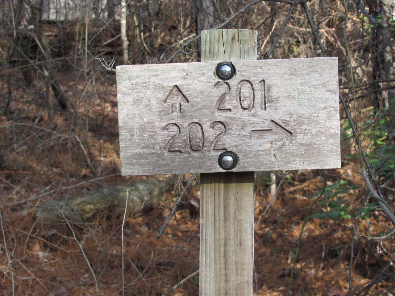
Our trail for today was 201, the Rippey Trail

By the way, we’re getting our trail information and description from the Sipsey Wilderness Hiking Club webpage.  Their trail descriptions have been very helpful.  Of course, we also carry that very detailed map we got at the sporting goods store.  I’m not sure where the trail names come from.  The Forest Services uses numbers on all their documents to identify the trails.  The map we got at the sporting good stores uses numbers to identify trails.  The Sipsey Wilderness Hiking Club uses these same numbers, but they also have names attached to those numbers.  Personally, I like trail names.

The 2.6-mile Rippey Trail starts at the Randolph Trailhead on CR 60.  This is a small parking lot with room for only about 8 cars.  Our map indicates it is a fee area, but there was no iron ranger or fee envelopes.  We hung our National Park pass in the window just to be on the safe side.  At the trailhead, there is a kiosk with a map and the trail just to the right.  There is a gated gravel road to the left.  The trail joins this road so it’s possible to hike the road instead of the trail for the first quarter mile or so.  We took the trail on our way out and the road on our way back.
Deciding where to go next.

The Rippey Trail was almost the opposite of what we did yesterday on the Borden Creek Trail.  The Borden Creek trail started down in the gorge and followed the creek for the entire length of the trail.  Today, on the Rippey Trail, we started on the ridge and stayed there for the entire length of the trail giving us a very nice woods walk.  We only passed one campsite today compared to the many we saw yesterday.  Although the terrain was relatively flat on the ridge, there was no water which would make overnight camping difficult.  The one campsite we saw was within 15 minutes of the trailhead; a short enough distance that a backpacker could carry in water.

We were real glad the trail had been cleared through these blowdowns.
We saw a lot of blowdowns along this trail, but fortunately they had been cleared.  Technically, in a designated Wilderness area, blowdowns muct be cut with a hand saw or an axe.  No tool with a motor can be used.  We were very grateful for the hard work done to clear those trees.

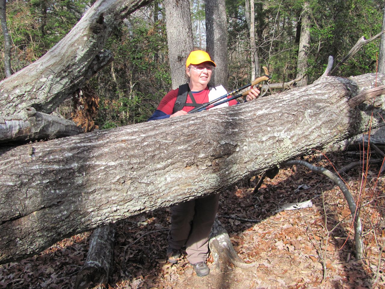
This was a short, easy trail so we found ourselves at the junction with the Sipsey River and Thompson Creek trails after about an hour.  We weren’t ready to turn around just yet, so Gene studied the map to determine our best choice.  We decided to take the Thompson Creek trail off the ridge and down into the gorge.  Thompson Creek trail did not have its blowdowns cleared and we spent a considerable amount of time crawling over, under, and through fallen trees--a true wilderness experience.
I think I'm getting too old for this!

Thompson Creek trail is rated moderate and, besides the blowdowns to navigate, we also had a pretty steep descent down to the creek.  Once we were near the creek we started seeing campsites again and stopped at one for our lunch.  After a nice long break we turned around, headed up the bluff, through all those fallen trees, and back to the car.
Heading down into the gorge through a laurel thicket.

It was another beautiful day and a great hike.

Lunch at a campsite by the creek.
That’s all for now.  Thanks for tagging along.

Friday, December 2, 2011

Bankhead National Forest

The day got off to a frosty start, but quickly warmed up and turned out to be a beautiful day for a hike.  Although we were anxious to be on the trail again, we didn’t rush out the door at the crack of dawn.  We wanted to give those deer hunters plenty of time to do their thing before we got out there.
Sipsey River

We had about a 40 mile drive over to the Sipsey Wilderness area of Bankhead National Forest, named for U.S. Representative William Bankhead.  Bankhead covers some 181,000 acres and is Alabama’s largest National Forest. The Sipsey Wilderness is the largest wilderness area east of the Mississippi.  It also has the reputation of being Alabama’s most rugged hiking terrain with high limestone bluffs with drop offs into deep gorges.
Limestone bluff with a small cave at the base

On our way to the trailhead, we passed one of the Ranger Check In areas.  We pulled in there to see if we could get any more information about hunting restrictions or safety zones.  Boy, did we luck out.  Not only did they give us a map, but they also gave us a calender listing where the hunters could be on any given day.  The area we planned to hike in this week is on the West side of County Road 33 and the hunters are on the East side of the road today and tomorrow, then there’s no hunting all next week.  Wore our orange hats anyway since we saw a study which indicates 20% of Americans can’t read.

Our hike today was along the Borden Creek Trail within the Sipsey Wilderness.  As a designated “Wilderness”, there are no improvements to the trail such as foot bridges or stone steps like we would see in State or National Parks.  Neither is the trail blazed, but it is a well traveled path and easy to follow.
Borden Creek
The water was clear in Borden Creek with a sandy bottom; something we rarely see in Tennessee

The trailhead we used was at the Sipsey River Picnic area on Rt 6.  There is plenty of parking there and a standard government issue pit toilet.   There is a $3 fee to park, but we hung our National Park Annual Pass in our window and that works for National Forest, too.

There are actually two trails that start at this trailhead.  Sipsey River Trail and Borden Creek Trail follow the Sipsey River north for about a half mile to the point where Borden Creek empties into Sipsey River.  The Sipsey River Trail fords Borden Creek and continues northwest.  Our trail, Borden Creek Trail, makes a right turn and follows Borden Creek upstream for another 2 miles.
Honeycomb-like surface created by water seeping through the soft limestone

This was a very nice walk through hemlock forest with Borden Creek on one side and the bluffs on the other.  The trail information we had rated it as a moderate hike, but I would say it was easy walking.  What gave it the more difficult rating were the stream crossings.  We had to cross about five small feeder streams.  Because of the wilderness designation, there were no foot bridges and the slopes down to the streams were steep and slippery.  Each of these little streams was fed by a waterfall at the bluff face.  It has been so dry lately that these falls were nothing more than a trickle of water.  Spring would be a different story, I’m sure.

This is a popular area for backpackers and we passed several primitive campsites.  Most were small and would accommodate only a tent or perhaps two.  However, the campsite where we stopped for our lunch break was huge with plenty of room for 8 or 10 tents.  In fact, on our way out we met a large group heading to that campsite.  They weren’t packing light, either.  They seemed to have everything imaginable, including a large cooler.
One of many campsites we passed today

There was one major obstacle on this hike and I’ll have to admit I refused to go there.  Very near the northern end of the trail is a tunnel through the rock--very narrow and very dark.  It is only about 15 feet in length, but because it is “L” shaped, we couldn’t see the light at the other end.  I could not go in that hole.  The north side of the tunnel comes out behind one of those waterfalls.  We decided this was a pretty good place to turn around.
I couldn't go in that hole!

We had a great hike today and we’ll be back to Bankhead two or three more times this coming week.

That’s it for today.  Thanks for tagging along.

Thursday, December 1, 2011

Home, Sweet Home Alabama

It was sure enough cold this morning when Gene went out to unhook our utilities and air up the tires.  Thankfully, it wasn’t raining.  There were fog advisories, but there wasn’t any fog up on the ridge in Joelton--just beautiful blue skies.  We were anxious to get going, but forced ourselves to take it easy long enough for the morning rush hour traffic to die down.  By the time we finally pulled out of the campground, most of the traffic was gone and so was the fog.
Crossing the Tennessee River

The only fog we actually saw was near the downtown area around the Cumberland River.  If fog can be pretty, this was.  The moisture had frozen on the tree branches and was simply beautiful.  I grabbed the camera, but not in time.  The only picture I got as we were zipping by was of the side of a semi heading in the opposite direction between me and the trees.
There was plenty of water in the Tennessee River today.

We got out of Nashville without any major delays and had a pleasant drive down I-65 to the Alabama Welcome Center.  While I fixed lunch, Gene went in the Welcome Center to gather up any information he could find about Bankhead National Forest.  He was really looking for trail maps of Bankhead, but didn’t find much at the Welcome Center.  The lady behind the counter was kind enough to photocopy a couple of things that were not available in brochure form.
Rocket at Alabama Welcome Center

After a relaxing lunch, we continued on our way to Cullman, Alabama.  The small town of Cullman (population about 15,000) is located just off I-65 almost exactly halfway between Huntsville and Birmingham.  We’re going to be here for at least a week while we do some hiking in Bankhead and the Sipsey Wilderness area.

Cullman is several miles from the National Forest, but Cullman Campground was the best and closest campground with full hook-ups.  Bankhead has several campgrounds, but this is off season and all but one of the campgrounds are closed.  It’s good to have electricity on these cold nights anyway, so here we are.  More about the campground later on.

After we got settled in our site, we continued our search for a good trail map.  The campground office was able to give Gene the name of a couple sporting good stores, one of which had a map like he wanted.  We rushed on over to purchase the map. While we were in the store, we asked about hunting.  We’re in the midst of hunting season right now and Bankhead is open to hunters.  You can be sure I’ll be having that orange hat upon my head.  We looked around the store a little after we got the map and information we came for.  I have to tell ya--I’ve never seen so much camo in all my life.  Even the rifles were camo.  I guess if you dripped your gun you’d never be able to find it.

So, we’re armed with our maps and orange hats, hiking boots and packs.  Tomorrow, we’ll be on the trail again.

That’s it for today.  Thanks for tagging along.