Showing posts with label AT. Show all posts

Monday, June 4, 2012

Charlie's Bunion


No, this post isn’t about any foot abnormalities Gene might suffer from even though his first name is Charles.  This post is about a geologic feature found along the Appalachian Trail some four miles from Newfound Gap in Great Smoky Mountain National Park.

Charlie's Bunion
How Charlie’s Bunion got its name is an interesting story.  Like most things, it came about as a result of a series of events.  First came the logging companies in the early 1900s.  Then they were all about making the money fast and, in their hast, the loggers cut the trees and moved on leaving the stumps and piles of rubbish behind.  Next, in 1925, came the fire which burned this left over mess along with 400 acres of woodland and left the mountainside a charred, black scar.  A few years later came the downpour of epic proportions which washed rock, dirt, and timber off the slopes to the rivers and creeks below.  After the storm what remained was this jagged rock face.

Horace Kephart led a hike for a couple of his buddies to investigate the damage left by the storm.  Among his group of hikers was a man named Charlie Conner.  As the story goes, when the they approached the jagged rock someone asked its name and Kephart replied “Charlie’s Bunion”.

View from Newfound Gap parking lot
Our hike to Charlie’s Bunion began at Newfound Gap parking area.  On clear days, Newfound Gap offers spectacular views of the mountains.  Since a cold front passed through on Saturday, we thought Sunday might be a good day for views off Charlie’s Bunion.  Also, around the area are sand myrtle which we were hoping to find in bloom.  This is another very popular hike in the Smokies, so once again we got an early start.


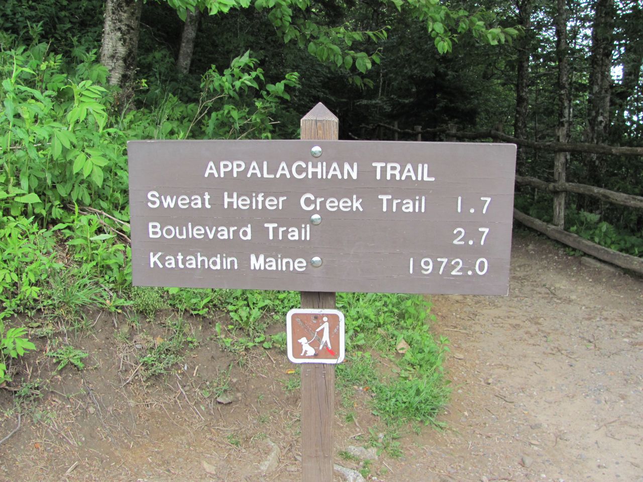
We stepped onto the Appalachian Trail near the 200 mile point.  This section of the AT was built in the early 1930s by 22 guys with picks and shovels.  The AT runs almost 70 miles through the Smokies with Newfound Gap being near the center.  Today, the first half mile of our hike is on one of the busiest trails in the Park, but past Charlie’s Bunion the AT quickly becomes too remote for most day hikers.

The AT is the only trail in the Smokies that is blazed.
From Newfound Gap the trail climbs quickly gaining almost 1000 feet in the first 1.5 miles before it begins to taper off.  By the time we made that climb we were ready for a break and Icewater Springs Shelter was just the spot.  The shelter gets its name from the nearby spring which runs very cold, but, like all wild water, should be chemically treated, filtered, or boiled before drinking.

Icewater Springs Shelter. All that rock work in front of the
shelter was just put in on Saturday

View from our lunch spot

Past the shelter the trail descends for 500 feet over the next mile before reaching Charlie’s Bunion.

Lunch at the Bunion

There were several folks at the Bunion when we arrived.  Most were climbing or sitting out on the rock, but that’s not for us.  Way to far to fall if you slipped.  We chose a spot around the corner and a little more out of the wind for our lunch break.  The views were spectacular, of course, but the sand myrtle was past its prime.  We were happy to see the few blooms left.


Sand myrtle

After a long lunch and some more time admiring the views, we headed back to the car.  Once again, we stopped at the shelter for a break and had the opportunity to meet and talk with the trail maintainer for this section.  The Smoky Mountains Hiking Club maintains the AT through the Smokies and they to an excellent job.  Trail building and maintenance is backbreaking work and most is done by volunteers.  We found Pete, an elderly gentleman (maybe 70), near the shelter rearranging dead logs which he was planning to use as steps and water bars on the trail.  Pete, a volunteer himself, is the supervisor of the trail crew for this section.  His goal for this summer is to repair the trail between Newfound Gap and Charlie’s Bunion, a 4 mile section.  He’s also making improvements at the shelter--installing new signs and repairing the muddy area in front of the shelter.  Pete spends three days a week working on the trail.  He hauls his stuff, including tools, to the shelter where he’ll spend his nights.


Our hats are off to Pete and all the volunteers who maintain trails.

We had some great views along the trail

We want to welcome our latest follower, Sonny.  Sonny and his family love being outside hiking and geocaching.  They’re starting to think about retirement and RVing is becoming part of those plans.  Welcome, Sonny.  We’re glad to have you tagging along.


That’s all for today.  Thanks, everyone, for tagging along.

Tuesday, May 1, 2012

Nantahala Outdoor Center


We have finally left the Smokemont Campground in Great Smoky Mountains National Park.  I just love the National Park camping experience.  It is so peaceful and serene with the song of the babbling brook (in this case the Oconaluftee River and Bradley Fork), the birds, and the trees.  The sites are large and since this is still too early for many vacationers, it almost seemed like we had the place to ourselves, especially during the work week.

The Smokemont campground has been closed over the past several months for some much needed renovations and repaving of the interior roads.  Every driving surface in the campground was repaved--roads, parking areas, campsites, dump station.  Wonderful!  The restrooms were renovated as well--not so far as hot water, but a fresh new look.  A lot of work has gone into this campground and we enjoyed our stay there.

However, over a week without hookups was plenty.  I can do pretty good without electricity, but I really don’t like to be without cell service.  It’s not so much the internet that I miss, although it is an important part of my day with my own blog and keeping up with the blogs I read, but I really don’t like to be without a telephone.  With elderly family members an emergency could pop up at any time.  I want to be able to get a call.  I want to be able to make a call if I have an emergency myself.  We’re back to civilization now.  As wonderful as our stay at Smokemont was, I was ready to leave.

Nantahala Outdoor Center
Saturday, we needed a rest from our hike on Friday and decided to drive to Wesser, North Carolina to Nantahala Outdoor Center (NOC).  There’s really not much to Wesser; just a small General Store, three or four restaurants, a fly fishing shop, and NOC.


Oops, an unmanned raft is not a good thing.
It’s mostly all about the Nantahala River which runs through the Nantahala Gorge and offers some of the best whitewater around here.

This doesn't even look like fun to me.


Oops!
NOC is many things.  They offer kayaking and rafting lessons and guided trips not just on the Nantahala River but on several rivers in the area.  They rent equipment and they also sell equipment and clothing.  That’s why we went--to finger the merchandise.  There was a lot of stuff to choose from, but after much looking we only came away with one pair of hiking socks.

The white blaze of the AT as it heads north over the bridge
I said NOC is mostly about the river.  Their other big customer is the Appalachian Trail hiker.  The trail crosses the Nantahala River on the bridge right next to the store.  The weary hiker is always looking forward to reaching NOC.  They have a hiker hostel and a few private rooms to rent.  NOC is about 135 miles from the southern end of the trail on Springer Mountain in northern Georgia and many hikers are looking for a diversion from hiking all day every day.  NOC has the river and they plunge right in.

A class in session
We had brought our own lunch so we “hiked” the AT across the bridge and found a picnic table on the bank of the river.  Since we didn’t have any obligations for the rest of the day we just hung out enjoying the nice spring weather and watching what few brave souls there were on the river this early in the season.

Mr Confidence
On our way home we decided to check out a campground near Fontana Dam.  Mother and I had tent camped there years ago.  It is very conveniently located to the Twentymile area of the Park and since there are a couple trails I need to hike in that area, this campground came to mind.  We drove through the campground, but it was a little too rough around the edges for my taste and the road down to it was a little to narrow, curvy, and steep for Gene’s taste.  We decided to pass on that and look for something else later.
Fontana Lake
It turned out to be a full day and I guess we really didn’t get all that much rest.

That’s all for now.  Thanks for tagging along.

Saturday, March 17, 2012

Mountain Crossings at Walasi-Yi

Mountain Crossings is a unique and special place.  Located on US19 near Blairsville, Georgia in Neels Gap it sits atop the Appalachian Trail.  The building has two sections separated by a breezeway.  This breezeway is unique in that the Appalachian Trail passes right through.

This historic stone building was built by the CCC in the mid-1930s and opened in 1937 as the Vogel Lodge.  For the past several years it has been an outfitter for hikers, especially the AT thru hikers.  Besides being an outfitter selling all manner of hiking equipment, it is also a small grocery stocking a variety of trail appropriate foods (noodle side dishes, instant oatmeal, snack crackers etc), a limited selection of fresh fruits, and a wide selection of candy bars.  Mountain Crossings is also a fast food restaurant offering hot dogs, microwave pizza, and ice cream by the pint.  About a third of the store is dedicated to a gift shop with a real focus on AT merchandise, but also a very nice collection of handmade pottery.  There is, of course, the T-shirt and baseball cap sections, as well as books.
Little hard to see the AT blaze on the brick by the downspout,
but the AT passes through this breezeway and up the mountain behind.
On the lower level of the residential side is the hiker hostel.  Mountain Crossings is 30 miles by trail from Springer Mountain, the southern terminus of the AT.  It takes the average hiker 4-5 days to reach Neels Gap and they are more than ready for a hot shower and a bed to sleep in.

Mountain Crossings is turning into somewhat of a museum of sorts, displaying well worn gear from some famous and some not so famous thru-hikers.  Two things in particular they seem to be collecting are boots and backpacks.  These items are displayed from the rafters and walls or just sitting on the floor around the store.  Hanging from a large tree on the front lawn is a mighty collection of old boots.

Not all hikers who begin their AT journey at Springer Mountain are seasoned backpackers.  Many limp into Mountain Crossings with feet covered in blisters, wearing jeans that have rub their skin raw, and carry 50 or 60 pound loads on their backs.  The staff at Mountain Crossings are famous for their hiker “shakedowns”.  Some hikers come begging for assistance in lightening their loads and tips on being more efficient in the wilderness.  Others get it whether they want it or not.  When the staff sees someone putting themselves in danger with what they’re carrying, they don’t hesitate to offer a few suggestions.

For the past 10 years or so Winton Porter has been the proprietor of Mountain Crossings and he and his staff have seen every type of hiker imaginable over the years.  Winton has written fantastic book called Just Passin’ Thru in which he relates some of the things he’s seen and heard as hikers, hundreds of them, have passed through his breezeway.  It’s an enjoyable read even if you’re not a backpacker.

So, there you have it--all I know about Mountain Crossings, but you really have to go there to appreciate the feel of the place.  Just sit on the porch and take it all in.

That’s it for today.  Thanks for tagging along.

Thursday, March 15, 2012

Hike to Len Foote Hike Inn

Gene and I have had several conversations trying to decide if we were really ready to tackle a 10 mile mountain hike.  After the Blood Mountain hike we felt pretty good and decided we’d go for it, so this morning we were off before daylight to Amicalola Falls State Park to hike the 5-mile trail to Len Foote Hike Inn.

Amicalola Falls is about 40 miles from Vogel State Park, but in the dark over these curvy mountain roads it took a little over an hour to get there.  We knew 10 miles was going to take some time so we got an early start.

Our first stop was at the Visitor Center to get a permit to hike the Hike Inn Trail.  The permit is free, but it took some time to get signed up.  Amicaloa Falls State Park is the home of the Approach Trail which leads up to the top of Springer Mountain and the start of the Appalachian Trail.  March 15th is one of the big start dates and the Visitor Center was swarming with hikers.  As we waited to get our permit, we watched as the 341st hiker this year registered to thru-hike the trail.  He was pretty excited.

When it was our turn to sign up for a permit we learned that you can make a loop hike connecting the Hike Inn Trail with the Approach Trail.  From the map we had and the map online, we could not tell for sure if that was possible.  We were glad to know we could hike a loop, however, it was 11 miles instead of 10.  What’s one more mile, we could do that.  Piece of cake.

After we got our permit, we drove up to the large parking lot at the top of Amicaloa Falls.    This is where our hike started.  There are better views of the falls from down below, but this is a pretty cool view from the trail right at the top of the falls.


From this parking lot The Hike Inn Trail and the Approach trail are the same for about a quarter mile.  Then they split and the Hike Inn Trail veers off to the right.  This trail was a real dream with wide, hard packed dirt treadway over moderate ups and downs.  There were mile posts so we knew how far along we were and at every mile there was a nice resting bench for breaks.  We stopped at every bench.  There were about 4 creek crossings.  Some had foot bridges, some didn’t, but they we easy rock hops.  No wet feet today.

The Len Foote Hike Inn is similar to other inns, cabins, and lodges which require their guests to hike to the facility.  This hike was much easier than any of the trails leading to Mt LeConte in the Smokies which can’t even compare to the trails to Phantom Ranch in the Grand Canyon.  The Len Foote Hike Inn has about 20 guests rooms, a bath house (with hot showers), and a dining hall which serves family style meals.  The rates are about $150 (double occupancy) per night which includes dinner and breakfast.  On our hike up this morning, we saw 11 of last nights’ guests as they were coming down the mountain.
At the Inn we wandered all around seeing what we could see, then went into the dining room to eat our lunch.  They do not serve food except to guests, but there is always coffee, tea, and lemonade for the day hikers who stop in.  We helped ourselves to a beverage to go with our sandwich.  They also had some bread pudding left over from the breakfast meal.  They offered us some of that, so we were very contented hikers. Best trail lunch I’ve had in a long time.


The Hike Inn Trail continues on up the mountain from the Inn for another mile where it intersects with the Approach Trail.  By the time we got to the Approach Trail, we could hear thunder in the distance and the sky to the west was getting dark.

Blood Root
The Approach Trail is not continuously uphill, although it may feel like it to the heavily burdened thru-hiker.  This trail has its ups and downs and is much steeper than the Hike Inn Trail.  Our feet were screaming by the time we got back to the car.  Even though this portion of our hike was hard, it was very enjoyable.  We saw many, maybe 20, thru-hikers on their first day of their journey to Maine.  I can’t imagine what they must feel.

I'm using the sign to prop myself up.
Eleven miles was plenty for today, especially when the rain caught up to us.  We hiked for about a mile in rain gear. Needless to say, we were happy to see the car.

Tomorrow will be a driving day for us as we head for Nashville.  For now, it’s off to bed.

Thanks for tagging along.

P.S. Chick-fil-A has great chocolate shakes.

Wednesday, March 14, 2012

Appalachian Trail Up Blood Mountain

Our hike today was awesome.  Perhaps part of that feeling of awe was due to our eagerness to get back to some mountain hiking after a couple months in Florida.  Other factors contributed to a great hike--the weather was just about perfect, we had fabulous views from the top, and we saw dozens of young hikers bubbling over with enthusiasm as they get started on their quest to hike the entire Appalachian Trail.

We were also very pleased with how well we did for a first mountain hike in a very long time.  The trail from Neels Gap to the summit of Blood Mountain is 2.4 miles with 1336 feet of elevation gain.  We made the summit in an hour and forty-five minutes. We really didn’t take a break.  We stopped once and sat on a rock to rest for about 5 minutes.  However, we stopped often to talk to the hikers coming down the mountain to Neels Gap.

There are numerous legends about how this mountain got its name.  One of the more popular tales involves the Creek and Cherokee Indians.  Before this area was inhabited by the white man, these two Indian nations engaged in a battle so fierce that the creeks coming down the mountain side ran red with blood.

We began our hike southbound on the AT at Mountain Crossings.  The outfitter was kind enough to let us leave our car in his parking lot.  Their parking lot isn’t very large and they get a lot of business so they ask that day hikers park at a parking lot a quarter mile down the road.  I’m sure they wouldn’t have been so accommodating later in the season.  We were grateful for their kindness today and probably spent more in the store than we otherwise would have.

From Mountain Crossings we crossed to the other side of US19 and started up the hill.  Almost immediately we came to a sign welcoming us to Blood Mountain Wilderness Area and Chattahoochee National Forest.  Being the AT, the trail is blazed in white.  Being the beginning of thru hiker season, it was very evident that the Georgia AT Club had been hard at work to get their section of trail in topnotch condition for the hikers coming through.


The first mile of the hike was on primarily dirt through eastern hardwoods and laurel thickets.  After about a mile we came to Flatrock Gap and the trail junction with the Byron Reece Trail.  We continued up hill.

The second mile was considerably steeper than the first gaining most of that 1300 feet.  The trail also changed from dirt to rock.  As we approached the summit we were walking across large slabs of granite.  It was in this section that we had the best views.

At the summit, we stopped for a few minutes at the Blood Mountain Shelter.  This old stone building has the reputation for being the coldest shelter on the AT.  The building dates back to the 1930s.  We think it was built by the CCC as a trail shelter.  It has concrete floors and stone walls.  The fireplace has been bricked up.  It looks like the roof has been recently replaced.  There were lots of hikers hanging around so we only stayed a few minutes.

Out in the sunshine and a much more enjoyable place for our lunch break was back to one of those granite slabs.  We found a spot not too close to the edge to take in the view while we ate.  Gene even made us a cup of hot chocolate.  We had our dessert at Mountain Crossings after the hike--an ice cream bar.  They had a freezer full of pints of Ben and Jerry’s, but we hadn’t hiked nearly enough miles for that.

Our descent was a little faster than the ascent.  We both put on knee braces to come down that steep section at the top.

Mountain Crossings deserves a whole story for itself.  It is a special place.  I’ll save that for another day.

I think that about does it for today.  Thanks for tagging along.

Thursday, March 1, 2012

March, The Start of Spring Hiking Season

As hikers living in middle Tennessee, we were always anxious for March to arrive.  Warmer temperatures bring on the lure of the trail.  It also brings out an array of spring wildflowers and blooming shrubs and trees which turns the trail into a masterpiece.  In our minds it was the beginning of spring hiking season.
Appalachian Trail Marker in sidewalk in Hot Springs, NC
March is also the beginning of Appalachian Trail thru-hiker season.  Of course, there are always a few hikers who are willing to brave the freezing temperatures and snow who start on their thru-hike early, but most wait for “spring” on Springer Mountain.  March and April will see hundreds of hopeful hikers head north from Springer in Georgia on their quest to reach Mt Katahdin in Maine before the snow flies.
Bloodroot
Many of these hikers post journals of their trip and each year I select a few to follow.  It’s not a random selection; I have my guidelines.  I have found I enjoy the narratives of hikers closer to my age rather than the younger ones.  I also like to select hikers who take the time to post about their preparations for the hike.  I have noticed that those hikers who are excited about preparations and want to share that excitement on their journals will be the ones who will post often during their hike.  I have selected six hikers to follow.  These are the three that I’m most excited about.
Star Chickweed
First is Bluevist.  She is one of those brave souls who started Jan 1st.  She is already through Georgia and the Smokies and is well into North Carolina now.  She is hiking alone, which is relatively unusual on the trail, however, women are more and more going on their own.  This is the 10th anniversary of her first thru-hike which she completed in 2002. She has gone out for winter hikes (what she calls walks in the woods) for the past several years.  She hikes as far as she wants and then gets off the trail.  She doesn’t actually say she’s attempting a thru-hike this year, but she seems to be sticking with it even through the snow in the Smokies.  She knows what the Trail is all about and the difficulties of a long distance hike.  I wish her a safe and enjoyable hike whether or not it turns into a thru-hike.
Crested Dwarf Iris
Next is Richard Lindsey.  Richard’s journal caught my eye because he’s hiking with his son, Alex, who recently graduated from high school.  They are from Washington state and are leaving early in March for a drive across the country to begin their hike about the middle of March.

Last are Headnout and Tagnalong.  These are unusual trail names and when I saw them on the 2012 journal list, I immediately clicked to see who they were.  Sure enough, they had done a thru-hike in 2006.  I recognized the names of the older couple we had dinner with at Zealand Hut in the White Mountains.  The hut system in the Whites is a blog in itself, but for the purposes of this story, I’ll just say that the AT passes most of the huts in the White mountains.  Many thru-hikers work for their stay at the huts as they pass through the Whites.  Gene and I were among the 36 guests at Zealand Hut the same night Headnout and Tagnalong were there working for their stay.  We had a great conversation with them that evening.

Trillium
So, back to their trail journal--After that hike in 2006, Headnout went on to hike the Pacific Crest Trail in 2010.  They have decided to thru-hike the AT again this year in celebration of (are you ready for this)--their 49th wedding anniversary.  Isn’t that great! They’ll be starting March 8th, on their anniversary.  They are accomplished long distance hikers and will make it to Mt Katahdin barring injury or other health issues.

These are my favorite picks for journal reads from this years group of Appalachian Trail thru-hikers.  I wish all the hikers a safe journey and I’m anxious to follow along through their Trail Journals.

That’s it for today.  By the way, all of today's photos were taken in previous springs.  Thanks for tagging along.