Monday, April 5, 2010

Rich Mountain Loop Hike


As I have mentioned before, the Cades Cove Loop road is closed for repaving.  I’m not complaining.  It has been needing to be fixed for a number of years.  It is closed a couple mornings each week to motorized traffic so bicyclists can ride the loop without danger of death or dismemberment from drivers looking at the bears instead of traffic.  I have tried to ride that loop a few times on my bicycle and it was so full of pot holes and broken pavement that it was not worth the effort.  We’re glad the road is getting a much needed facelift.  However, there are several trails back there that are not accessible due to construction.  It is a beautiful area and we miss not being able to hike back there.


Today’s hike was about as close as we could get to Cades Cove--Rich Mountain Loop Hike.  We started from the Rich Mountain trailhead located just a few feet past the gate which blocks traffic to the loop road.  The first mile and a half is pretty flat, but then ascends steeply for the next couple miles where we picked up Indian Grave Gap Trail.  We continued our climb over the top and then descended along the Crooked Arm Trail.


Early in our hike, we came to the Oliver cabin.  Cades Cove was a relatively large settlement of frontier farmers during the 1800s.  John Oliver built this small cabin around 1819.  Today, the park service maintains this, as well as several other cabins and churches, as a way to help the modern visitor get a sense of what life in the early 1800s was like in this area.

Had several opportunities to use the saw today.
We saw a few wildflowers again today, but it is a little too early for the mountain laurel to be in bloom.  Too bad, it makes for a beautiful hike.  Perhaps the highlights of the hike were the splendid views we had from Rich Mountain looking down into Cades Cove.  I love those views.  You can’t get them in the summer when the trees are in leaf.

It felt like summer out there today and we got pretty hot.  Without leaves on the trees there is no relief from the sun.

Another big climb today of over 1700 feet, 8.5 miles of trail, in five and a half hours total elapsed time.  We are very happy with our progress.

Tomorrow will be a rest/chore day.  I’ve got to wash some of these smelly hiking cloths. The remainder of the day will be devoted to REST.

Lumber Ridge Trail


We had another beautiful day and another wonderful hike.


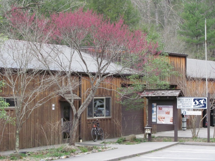
Lumber Ridge Trail starts at the Smoky Mountain Institute at Tremont.  The Institute offers environmental educational programs for groups of all ages.  There is also a small gift shop in the building, but the only thing I was interested in this morning was the restroom facilities.  I did stop long enough to admire the redbud blooming out front.


The trail starts with a 1000 foot climb over the first couple miles, then drops down about 500 feet before it levels off for the last mile and a half.  We saw several patches of wildflowers today--more bloodroot, yellow violets, long-spurred violets, and rue anemone.  We also saw what we think were buckeye trees in bloom.


Our trail ended after 4.1 miles at the junction with Meigs Creek Trail in Buckhorn Gap.  We had our lunch there before our return trip to the car.   We were very pleased with our 5 hours total elapsed time for this 8.2 miles plus the 1000 foot climb.  Our goal is to do 8+ miles on all our hikes this week.  That ought to have my leg muscles screaming.


That’s all for today.  We’ll be hiking again tomorrow.

Sunday, April 4, 2010

More From Yesterday


Today has been kind of a catch up day around the house.  I spent my time labeling and organizing my photos, something I haven’t done is several weeks.  It doesn’t take long for it to be a monumental task.  Gene spent his time scrubbing the dirt off the roof of our rolling home.  A lot of effort for something you can’t see, but at least we know it’s clean.  This campground allows you to wash your vehicles.  Gene will take advantage of that while we’re here.  Not many campgrounds allow such an extravagance with water.

We had a very busy day Saturday.  Several things I wanted to share, but yesterday’s post was getting pretty long, so I saved some for today.  There were especially a couple things I felt needed to be further explained for the RVers about long-distance hiking.

I wanted to explain a little bit about trail names. Most long distance hikers have trail names--the name they go by on the trail.  We have often met people whom we know only by their trail names and have no clue what their real names are.  Gene and I have trail names of Trekker and Rising Fawn.  We chose our own names, but it is probably more common to be given a name by those you meet along the trail.  Names acquired from other hikers often reflect a personality or physical trait or a habit you exhibit while hiking.

I also wanted to explain about getting into town for resupply. Some people think that the long-distance hiker carries everything he needs for the entire trip.  It would be impossible to carry enough food for a 4-6 month trip.  Trail towns are those communities which are located close enough to the trail to offer relatively easy access for the hiker to leave the trail, come into town, do laundry, get a shower, and resupply food items.  Some towns are right on the trail or within a mile or two.  Others are far enough away to require a ride.  Sometimes the hiker can call for a shuttle, but in most cases, they hitch-hike.  Gene and I have hitch-hiked several times.  It is not my favorite thing to do.

Now, on to other stuff.

After dropping off Tango and Friar Tuck at the motel, we decided to drive back through the Park with a stop at the Sugarlands Visitor Center.  We were almost sorry we made that decision and didn’t tarry very long.  The parking lots were all full and that should have been our first clue to the crowds inside.  We could hardly get in the door, there were long lines at the information counter, and there was hardly room to stand in the small gift shop.  Two of the most popular places in the park are closed for road resurfacing--Cade’s Cove and Clingman’s Dome.  All those folks who crowd into Cade’s Cove and Clingman’s Dome were at the visitor center, I guess.  I’ve never seen it so overrun with people.

Seeing all those folks helped us to decide to stay home today.  We sorta needed another day off to rest from our hiking and we definitely needed to get a few chores done, but we are mostly just trying to avoid the crowds.


We met our friends, Rich and Patti, for a great evening together last night.  We have known these good folks for several years.  They were in our hiking club in Nashville before Rich transferred with his job to Maryville.  We don’t get to see them as often as when we all lived in Nashville, but we try to get together at least a couple times a year.  They invited us to join them for their Easter worship service last evening and then for dinner afterward.  We very much enjoyed the service.  Thanks for inviting us to go along, guys.  We had dinner at a new Mexican place near Oak Ridge.  The food was very good, but the conversation with friends was outstanding.  We talked and laughed until we were about the only ones left in the restaurant.  We’ll have another opportunity or two to visit or maybe even take in a hike together before we leave.

Well, it looks like this is another very long post.  At least, I think I’ve said everything I wanted to say and probably more than you wanted to read.  So, that’s it for today.

More From Yesterday


Today has been kind of a catch up day around the house.  I spent my time labeling and organizing my photos, something I haven’t done is several weeks.  It doesn’t take long for it to be a monumental task.  Gene spent his time scrubbing the dirt off the roof of our rolling home.  A lot of effort for something you can’t see, but at least we know it’s clean.  This campground allows you to wash your vehicles.  Gene will take advantage of that while we’re here.  Not many campgrounds allow such an extravagance with water.

We had a very busy day Saturday.  Several things I wanted to share, but yesterday’s post was getting pretty long, so I saved some for today.  There were especially a couple things I felt needed to be further explained for the RVers about long-distance hiking.

I wanted to explain a little bit about trail names. Most long distance hikers have trail names--the name they go by on the trail.  We have often met people whom we know only by their trail names and have no clue what their real names are.  Gene and I have trail names of Trekker and Rising Fawn.  We chose our own names, but it is probably more common to be given a name by those you meet along the trail.  Names acquired from other hikers often reflect a personality or physical trait or a habit you exhibit while hiking.

I also wanted to explain about getting into town for resupply. Some people think that the long-distance hiker carries everything he needs for the entire trip.  It would be impossible to carry enough food for a 4-6 month trip.  Trail towns are those communities which are located close enough to the trail to offer relatively easy access for the hiker to leave the trail, come into town, do laundry, get a shower, and resupply food items.  Some towns are right on the trail or within a mile or two.  Others are far enough away to require a ride.  Sometimes the hiker can call for a shuttle, but in most cases, they hitch-hike.  Gene and I have hitch-hiked several times.  It is not my favorite thing to do.

Now, on to other stuff.

After dropping off Tango and Friar Tuck at the motel, we decided to drive back through the Park with a stop at the Sugarlands Visitor Center.  We were almost sorry we made that decision and didn’t tarry very long.  The parking lots were all full and that should have been our first clue to the crowds inside.  We could hardly get in the door, there were long lines at the information counter, and there was hardly room to stand in the small gift shop.  Two of the most popular places in the park are closed for road resurfacing--Cade’s Cove and Clingman’s Dome.  All those folks who crowd into Cade’s Cove and Clingman’s Dome were at the visitor center, I guess.  I’ve never seen it so overrun with people.

Seeing all those folks helped us to decide to stay home today.  We sorta needed another day off to rest from our hiking and we definitely needed to get a few chores done, but we are mostly just trying to avoid the crowds.


We met our friends, Rich and Patti, for a great evening together last night.  We have known these good folks for several years.  They were in our hiking club in Nashville before Rich transferred with his job to Maryville.  We don’t get to see them as often as when we all lived in Nashville, but we try to get together at least a couple times a year.  They invited us to join them for their Easter worship service last evening and then for dinner afterward.  We very much enjoyed the service.  Thanks for inviting us to go along, guys.  We had dinner at a new Mexican place near Oak Ridge.  The food was very good, but the conversation with friends was outstanding.  We talked and laughed until we were about the only ones left in the restaurant.  We’ll have another opportunity or two to visit or maybe even take in a hike together before we leave.

Well, it looks like this is another very long post.  At least, I think I’ve said everything I wanted to say and probably more than you wanted to read.  So, that’s it for today.

Saturday, April 3, 2010

Friar Tuck and Tango


For you RVers who read this journal, this story may seem more like a nightmare I had or something that happened on another planet.  For all our hiking friends who read this journal, it’s just another day in the life.

Toilet tissue left as trail magic at Newfound Gap this morning
Part of our intent in coming to the Smokies was to spread a little “trail magic”.  I guess it’s about time I explained that term.  Long distance hikers on the Appalachian Trail (and any long distance trail, especially the Triple Crown--Appalachian Trail, Pacific Crest Trail, and Continental Divide Trail) will occasionally come across what they refer to as “trail magic”--some special treat or convenience along the trail.  It often comes in the form of a cooler full of cold drinks or a 6-pack of beer in the cold water at a stream crossing.  In our hiking, we have come across a few gallons of water on a particularly dry section, a cooler of fruit, and a man playing music for the enjoyment of the hikers.  One of my personal favorites was a garbage bag hanging from a trail junction sign.  Hikers have to carry out their own garbage and after a few days it can be a smelly burden.  Any appropriate place to off load garbage is a real treat.  Trail magic comes in a variety of forms and those providing the “treat” or “service” are called trail angels.

FDR dedicated the Park from this platform at Newfound Gap

Nice sunrise for our early morning start

For long distance hikers, any treat or service which makes the hike easier is a small blessing.  These folks carry everything they need to survive in the wilderness.  They may walk for several days before coming to a town close enough to the trail to resupply their food and get a shower.  In the case of the Smokies, it is 70 miles from where the Trail enters the park at Fontana Dam and its exit at Davenport Gap.  It crosses only one road and that is at Newfound Gap.

I had boiled and colored eggs, bought a bag of oranges, and a couple bags of chocolate Easter eggs.  We took this load of goodies up to Newfound Gap where the Appalachian Trail crosses the main road through the Smokies.  We left at the crack of dawn.  We knew the last shelter southbound was just about 4.5 miles from the road.  By the time the thru-hikers reach the Smokies after starting in Georgia, they are putting down some miles each day.  We didn’t want to miss them as they came out onto the road.  The sun was well up by the time we got from Townsend to the top of the mountain.


The first hikers we saw were those being shuttled up from Gatlinburg where they had had a nice night in a motel.  They jumped out of the van and were heading up the trail before we hardly knew what was happening.  One fellow lingered trying to get his socks and boots adjusted just right. Gene went over to speak with him and offer an orange.  Skywalker was a young fellow from New Hampshire.  He stuffed his orange in his pack and off he went toward Maine.

During the next hour, Gene and I debated whether or not to hike southbound to met the hikers coming out of the nearest shelter at Mt Collins.  I was still pretty tired from yesterday’s hike and wasn’t much interested in carrying a 3 lb bag or oranges and a dozen eggs up the mountain between Newfound Gap and Mt Collins.  We just kept sitting in the truck watching all the tourists.

About 10:15 a park ranger pulled up and came around to Gene’s window.  While he was talking to us, a hiker stepped up to ask the ranger if there was a regular shuttle down to Gatlinburg.  This was just what we were waiting for.  Gene offered to take the hiker and his friend down to town.  Friar Tuck and Tango put their packs in the bed of the truck and off we went.  Friar is from the Atlanta area and Tango is from Massachusetts and both are planning to thru-hike to Maine.  We enjoyed getting to know them briefly as we drove down to Gatlinburg.  We dropped them off at a hotel and wished them well on their journey.  Perhaps our paths will cross again as we make our way up the trail to Virginia.


Good luck, Friar Tuck and Tango.  Glad we were there to give you guys a lift.

This evening we are joining friends, Rich and Patti, for dinner.  Haven’t seen them since the Tennessee Trails Annual meeting last fall.  We are looking forward to catching up with them.

Friday, April 2, 2010

A Nine-Mile Loop Hike


Today’s hike, I think, was right about our limit.  We combined several trails to create a nine-mile loop.  We parked the truck at the same parking lot we were at on Wednesday.  We started up Schoolhouse Gap trail, turned left on Turkeypen Ridge trail, made another left at Finley Cane trail which took us up to Bote Mountain trail.  We turned left again and headed down hill to the truck.

It was an almost perfect day for a hike.  The sun was bright and the temperatures were in the low 80s. That is almost impossible to imagine since it was winter just last week.  In fact, it was almost too warm to hike.  I would have preferred it to be 10 degrees cooler.

One of four creek crossings

All the trails were in good condition.  All were horse trails, so were somewhat beat up from horse hooves.  That is to be expected, of course.  We’re happy the horsemen are willing to share with us hikers.  On Finley Cane trail there was one blow down which was too large for Gene’s saw.  We had to go around; not much of a problem for us, more so for the horses.  We found one large tree branch blocking our way on Turkeypen Ridge, but Gene quickly took care of it.  We had about 4 creeks to cross.  Previous hikers had laid stepping stones or logs to cross on so we didn’t get wet feet.


Even though we didn’t have any big climbs today, nine miles is still nine miles, and we were eager to get back to the truck.  However, we felt good about being able to do that distance and in only 5 hours--that includes breaks and lunch.

Tomorrow, we are going to drive up to Newfound Gap to spread a little trail magic along the Appalachian Trail.  We’ll need an early start if we want to catch the hikers coming out of Mt. Collins shelter.  I guess that means early to bed tonight.

A Nine-Mile Loop Hike


Today’s hike, I think, was right about our limit.  We combined several trails to create a nine-mile loop.  We parked the truck at the same parking lot we were at on Wednesday.  We started up Schoolhouse Gap trail, turned left on Turkeypen Ridge trail, made another left at Finley Cane trail which took us up to Bote Mountain trail.  We turned left again and headed down hill to the truck.

One of four creek crossings

It was an almost perfect day for a hike.  The sun was bright and the temperatures were in the low 80s. That is almost impossible to imagine since it was winter just last week.  In fact, it was almost too warm to hike.  I would have preferred it to be 10 degrees cooler.

All the trails were in good condition.  All were horse trails, so were somewhat beat up from horse hooves.  That is to be expected, of course.  We’re happy the horsemen are willing to share with us hikers.  On Finley Cane trail there was one blow down which was too large for Gene’s saw.  We had to go around; not much of a problem for us, more so for the horses.  We found one large tree branch blocking our way on Turkeypen Ridge, but Gene quickly took care of it.  We had about 4 creeks to cross.  Previous hikers had laid stepping stones or logs to cross on so we didn’t get wet feet.


Even though we didn’t have any big climbs today, nine miles is still nine miles, and we were eager to get back to the truck.  However, we felt good about being able to do that distance and in only 5 hours--that includes breaks and lunch.

Tomorrow, we are going to drive up to Newfound Gap to spread a little trail magic along the Appalachian Trail.  We’ll need an early start if we want to catch the hikers coming out of Mt. Collins shelter.  I guess that means early to bed tonight.