Showing posts with label Sipsey Wilderness. Show all posts

Monday, December 5, 2011

Randolph Trail

As you can tell from the title, we went out for a hike today.  The rain in the forecast was not predicted to be in our area until mid-afternoon.  We dashed out the door as quickly as we could this morning and drove the 50 miles over to Randolph Trailhead on CR 60.  This is the same place we parked Saturday for the Rippey Trail.  I still can’t believe we were on the trail before 9 AM.

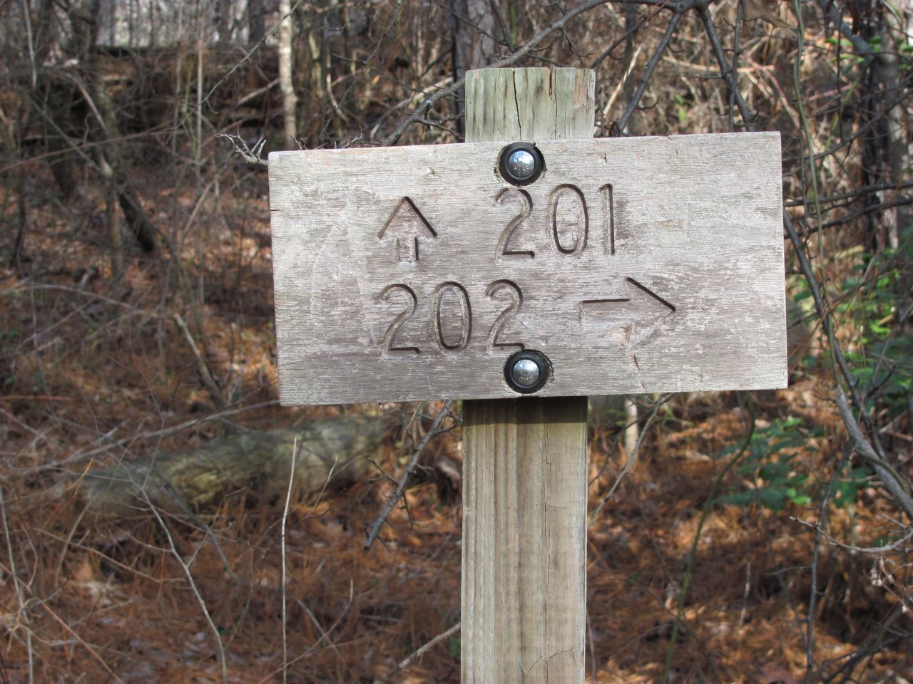
Again, we were hiking in the Sipsey Wilderness area and the Randolph Trail (#202) is 3.4 miles in length one way.  Randolph starts on the ridge, drops down into the gorge, and ends at the Sipsey River.  We were trying to beat the rain so we didn’t dilly dally.

Randolph and Rippey Trails run together for the first quarter mile or so.  At the junction, the Rippey trail branches off north and the Randolph continues east following the old road.  This road is the gated, gravel road just west of the parking lot.  We took the woods trail to the junction, but one could take the road if so inclined.  I think the distance is about the same.

After about a mile we came to the Johnson Cemetery.  Actually, there are two cemeteries; one east of the road and one on the west side.  These cemeteries are very old with graves dating back to the mid 1800s, but they are still well maintained.  There were even plastic flowers on many of the graves.  There were very few granite grave markers, most were just field stones.

Beyond the cemeteries, the trail continued to follow the old road bed, but was much more narrow.  Besides the cemeteries, there was a lot of evidence that this area had once been a small community.  We noticed small patches of yucca plants, metal culverts under the old road, and the occasional rusted car part or farm implement.

From a distance we noticed a huge tree with branches spread out in every direction.  Gene commented that he thought the tree had been there long before the forest grew up around it, otherwise the branches wouldn’t have been so wide spread.  Sure enough, when we got to the tree, there was a wide, flat area perfect for a small cabin and the rusted remains of an old vehicle, obviously a homestead at one time.  We passed on by, but later this became our lunch spot for the day.

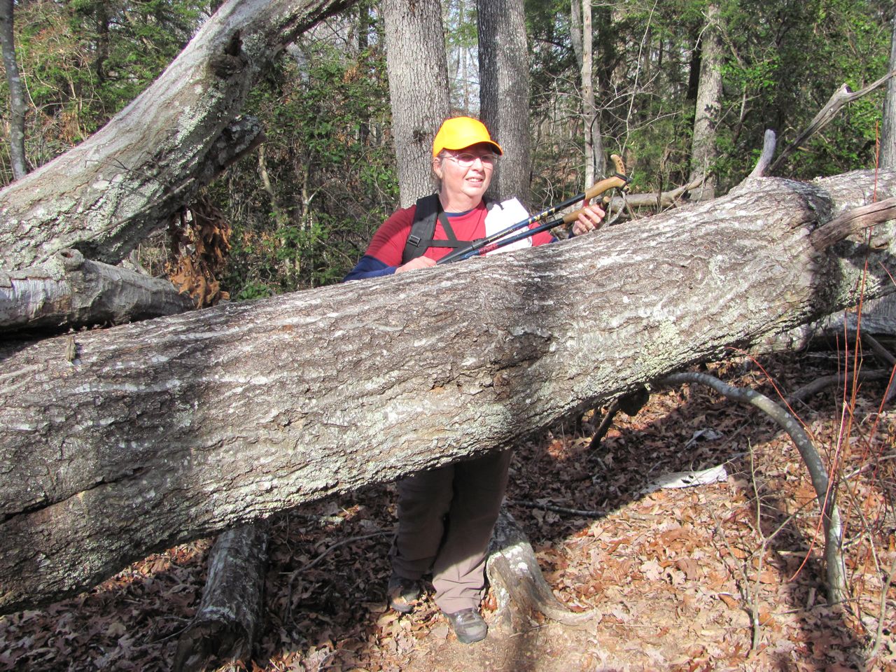
The trail, as it made its way along the ridge, had very gentle ups and downs making for a very pleasant woods walk.  As we headed into the gorge, naturally the trail became steeper, but not too bad.  We got those fine views of the limestone bluffs again and another trickle of water falling into a small feeder stream.  There were several blowdowns, but most had either been cleared or were easy to step over.  There were two that were a tangled mess, but previous hikers had made a path to bypass the worst of the hazard.
The sandy river bottom

We would have normally made the river our lunch spot since it was the halfway mark and turning around point in our hike.  However, we got there way too early to have lunch so we took a short break then headed back.

On our way back, Gene got his legs and feet tangled up on his trekking poles as he was crawling over one of the fallen logs.  He ended up falling down without injury to himself, but his trekking pole suffered a bad bend.  Gonna have to have that fixed.
Past its prime, but still pretty

We stopped for our lunch at the big tree.  While we were enjoying our PB&J, the wind picked up considerably and the sky was getting darker.  We didn’t linger.  We got our packs on, kicked in the afterburners, and sped on down the trail.  We got back to the car just as the first raindrops began to fall.  It was only a teaser, though.  The real rain didn’t start for another couple hours.

The forecast calls for rain all day tomorrow.  Guess we’ll be staying home relaxing.  Nothing wrong with that.  It actually sounds pretty good to me right now.

That’s it for today. Thanks for tagging along.

Saturday, December 3, 2011

A Sipsey Wilderness Adventure

With rain in the forecast for early next week, we wanted to get in as much hiking as possible.  This morning we headed back over to Sipsey Wilderness to hike the Rippey Trial.  Now that we knew there is no hunting in the area where we would be hiking we got an earlier start this morning.  We drove the 50 miles and were at the trailhead by 9:30 AM.
Our trail for today was 201, the Rippey Trail

By the way, we’re getting our trail information and description from the Sipsey Wilderness Hiking Club webpage.  Their trail descriptions have been very helpful.  Of course, we also carry that very detailed map we got at the sporting goods store.  I’m not sure where the trail names come from.  The Forest Services uses numbers on all their documents to identify the trails.  The map we got at the sporting good stores uses numbers to identify trails.  The Sipsey Wilderness Hiking Club uses these same numbers, but they also have names attached to those numbers.  Personally, I like trail names.

The 2.6-mile Rippey Trail starts at the Randolph Trailhead on CR 60.  This is a small parking lot with room for only about 8 cars.  Our map indicates it is a fee area, but there was no iron ranger or fee envelopes.  We hung our National Park pass in the window just to be on the safe side.  At the trailhead, there is a kiosk with a map and the trail just to the right.  There is a gated gravel road to the left.  The trail joins this road so it’s possible to hike the road instead of the trail for the first quarter mile or so.  We took the trail on our way out and the road on our way back.
Deciding where to go next.

The Rippey Trail was almost the opposite of what we did yesterday on the Borden Creek Trail.  The Borden Creek trail started down in the gorge and followed the creek for the entire length of the trail.  Today, on the Rippey Trail, we started on the ridge and stayed there for the entire length of the trail giving us a very nice woods walk.  We only passed one campsite today compared to the many we saw yesterday.  Although the terrain was relatively flat on the ridge, there was no water which would make overnight camping difficult.  The one campsite we saw was within 15 minutes of the trailhead; a short enough distance that a backpacker could carry in water.

We were real glad the trail had been cleared through these blowdowns.
We saw a lot of blowdowns along this trail, but fortunately they had been cleared.  Technically, in a designated Wilderness area, blowdowns muct be cut with a hand saw or an axe.  No tool with a motor can be used.  We were very grateful for the hard work done to clear those trees.

This was a short, easy trail so we found ourselves at the junction with the Sipsey River and Thompson Creek trails after about an hour.  We weren’t ready to turn around just yet, so Gene studied the map to determine our best choice.  We decided to take the Thompson Creek trail off the ridge and down into the gorge.  Thompson Creek trail did not have its blowdowns cleared and we spent a considerable amount of time crawling over, under, and through fallen trees--a true wilderness experience.
I think I'm getting too old for this!

Thompson Creek trail is rated moderate and, besides the blowdowns to navigate, we also had a pretty steep descent down to the creek.  Once we were near the creek we started seeing campsites again and stopped at one for our lunch.  After a nice long break we turned around, headed up the bluff, through all those fallen trees, and back to the car.
Heading down into the gorge through a laurel thicket.

It was another beautiful day and a great hike.

Lunch at a campsite by the creek.
That’s all for now.  Thanks for tagging along.