Showing posts with label Natchez Trace Parkway. Show all posts

Friday, November 18, 2011

Devil's Backbone

I think winter rolled in overnight.  We woke up to a very chilly 28 degrees.  They were predicting 24 and I wouldn’t be surprised if it didn’t get there.  We had the furnace turned down to about 60, but it ran most of the night anyway.  We were snug as bugs under our down comforter.  Peanut split his time between the floor in front of the heat duct in the bathroom and under the comforter.  Cat life is good.

A little nip in the air didn’t deter us from our hike at Devil’s Backbone State Natural Area located about 10 miles north on the Parkway.  With a name like “Devil’s Backbone” you might think it is a tough trail to hike, but not so.  It’s a pretty easy walk in the woods.  According to the signage, the entire trail is 3 miles in length. There is a half mile connector from the parking lot to a 2-mile loop.  The trail starts on the Highland Rim and follows the ridge line for about a mile before dropping down a couple hundred feet to a small creek, then climbs back up to the ridge.  The trail is in good condition, but all those beautiful leaves that were on the trees last week are now on the trail covering a multitude of rocks, roots, and ruts.  We took it slow and easy.

This was the only blowdown we couldn't just step over so we used it for a break spot.
We followed the creek for a short distance.
Hot chocolate tasted good on a cold morning.

On our way back to Meriwether Lewis, we stopped at Fall Hollow pull-out.  There is a short trail which leads to Fall Hollow Falls.  Actually, there are two different falls and the trail passes both.  There was quite a bit of water for this time of year.  Maybe the rains this week had something to do with it.  Even though it was about noon when we were there, there was still some ice around the falls.  We had debated whether to stop on the way to Devil’s Backbone.  If we had, the falls might have been a real winter wonderland.   The wet spots on the trail would have been icy, too.  That wouldn’t have been so good.

Judy of Travel’s with Emma fame, asked if the sites here at Meriwether Lewis are large enough to accommodate big rigs.  They are indeed.  Of course, some are larger than others.  There are two different type sites here.  There are back-ins and there are the half-moon or semi-circular type pull-thrus.  We are in the semi-circular type and it is maybe 60 ft long.  Most of the back-ins are 40-50 feet.  Of course, this is a wooded area and the trees may be a problem with slides.  However, we have neighbors on either side of us in 35-40 foot 5ers with opposing slides and there’s plenty of room.  There is also plenty of room for their trucks on the site, also.  This is the hills of Tennessee and there are varying degrees of level, but most are pretty good.

I mentioned yesterday that the interior roads have been repaved.  On the main road just before the turn into the campground, they have added a pull-out.  I don’t know what their intended purpose was, but it looks like the perfect place to disconnect your towed (or is that “toad”).

There are 2 other free campgrounds on the Parkway.  We have stayed at both of them and they are very similar to Meriwether Lewis.  All will accommodate big rigs.

One of the things on our “to do” list is to drive the Trace exploring its nooks and crannies, hiking its trails, and learning its history.  I expect it would take between one and two weeks to do it well.  There is even a guidebook, I think.

Another thing Judy wanted to know was if I use the generator to keep my computer charged.  I have an Apple computer and its battery will stay charged much longer than Gene’s PC.  I can get almost 3 hours of time on the computer before the battery has to be recharged.  Whenever we run the generator, which is usually once a day for about a hour, I make sure the computer and air card are plugged in.

That’s all for today.  Thanks for tagging along.

Thursday, November 17, 2011

Meriwether Lewis, Again

First time we've been hitched up since September


We made the move today from Millersville, just north of Nashville, to Meriwether Lewis, near Columbia southwest of Nashville, on the Natchez Trace Parkway.  The rains of the past two days are gone and we had a beautiful drive with bright blue skies.  It’s cold out there, though.  Also gone are our warm temperatures.
Crossed the Cumberland River as we made our way out of Nashville
Natchez Trace Parkway bridge over Highway 96
Not much traffic on the Parkway today.

We were very surprised upon arrival at Meriwether Lewis.  We were here for a few days last fall and since that time all roads in the entire park, including the campground, are new; so new they almost don’t look like they’ve been driven on.  In the campground, the interior roads as well as the parking pads have all been repaved.  The Natchez Trace is a unit of the National Park Service and the campgrounds along the Parkway are free.  However, there is no electricity and no dump stations, at least at Meriwether Lewis.  There are central water spigots and these have also been replaced.  Each site has a picnic table (ours looks fairly new) and a fire ring.  The campground is located along the ridge top so we have a nice view down into the valley.
Settled in for a few days

These campgrounds along the Natchez Trace are popular in the fall, especially with snowbirds from Canada.  I was concerned we might not get a site, but I shouldn’t have worried.  There are 30 or so sites here and only about 8 are occupied.  However, our nearest neighbor is from Ontario.
New trail signs to go along with the new roads

With the rains the past couple days we haven’t gotten much exercise.  Once we got set up (and there’s not much setting up to do when there are no utilities to hook up) we went out for a little leg stretcher.  There are several miles of trail here, but we didn’t have a lot of time for a real hike, so we just walked up the road to the Old Trace and cut across to the area were Meriwether Lewis, of Lewis and Clark fame, died.
And new split rail fences

There are several areas along the Parkway in which you can clearly see the historic old trace.  The Old Trace is part of the established trail system within Meriwether Lewis.  In October, 1809 Lewis came to this point on the Trace to spend the night at the Grinder Stand.  During the wee hours of the night he took his own life.  Some believe he may have been murdered, but most scholars lean toward suicide.  Anyway, Meriwether Lewis is buried here near where the Grinder House once stood.
Replica of the Grinder House
All that remains of the original Grinder house where Lewis died

Today, a replica of the Grinder House serves as a small park office on one side of the house with a small display about Meriwether Lewis and other historical sites along the Natchez Trace.
Lewis is buried beneath this monument.
Around the Lewis grave are the graves of several pioneers who lived in the area.

Our plan is to be here until Sunday.  Tomorrow, we want to do a little hiking just north of here at Devil’s Backbone and Saturday, the Clarksville chapter of Tennessee Trails will be hiking here.  We hope to join them for that hike.

That’s it for today.  Thanks for tagging along.

Wednesday, October 28, 2009

Meriwether Lewis on the Natchez Trace


One of the nicest drives to see fall color near Nashville is along the Natchez Trace Parkway.  The Parkway is operated by the National Park Service and consists of a two-lane scenic byway connecting Nashville to Natchez Mississippi, a distance of 444 miles.      This stretch of “road” is not new.  Originally, it was hunting paths for local Indians.  Later, the French and Spanish used the paths as they explored into the interior of the continent.  Andrew Jackson used the old trace road to move his troops to New Orleans during the War of 1812.  We probably best associate the Natchez Trace with the farmers who floated there crops down the Mississippi River to Natchez.  Since they sold everything they brought, included the flatboat, they had to walk or ride a horse back north.  This was their “road”.


Along the length of the Parkway are numerous turnouts to overlooks and scenic vistas, historic landmarks, campgrounds, and trailheads for hikers and horses.  The Meriwether Lewis Site is one of these features and is located at mile marker 385.9, about 60 miles south of the northern terminus at Nashville.  That was our destination for today.


Meriwether Lewis, in 1809, was on his way to Washington, DC when he stopped over for the night at Grinder’s Stand.  The Grinder family ran a small inn for trace travelers.  During the night, Lewis was shot.  There is much controversy, and the case is still a mystery, as to who fired the shot that killed Lewis.  He was buried near the Grinder Stand.  Near the middle of the 1800s, a monument was placed at the gravesite to commemorate this great man of American history.  The Grinder’s inn no longer exists, but a small 2-room cabin similar to other cabins of the period along the Trace has been erected and houses a small museum.

The Meriwether Lewis site also has a campground.  We did the grand tour and are pleased to report that it will accommodate large rigs.  There are several back-in sites and several of the semi-circular pull-thru sites.  It is a campground of the National Park type--lots of trees and no hook-ups.  However, it is free, as are the other campgrounds located along the Parkway.


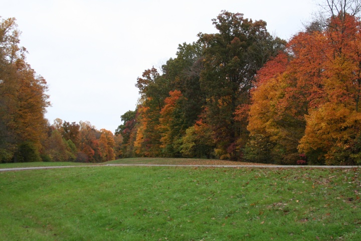
We were not disappointed in our drive along the parkway.  The fall color, though past its peak, was still fabulous on this overcast day.