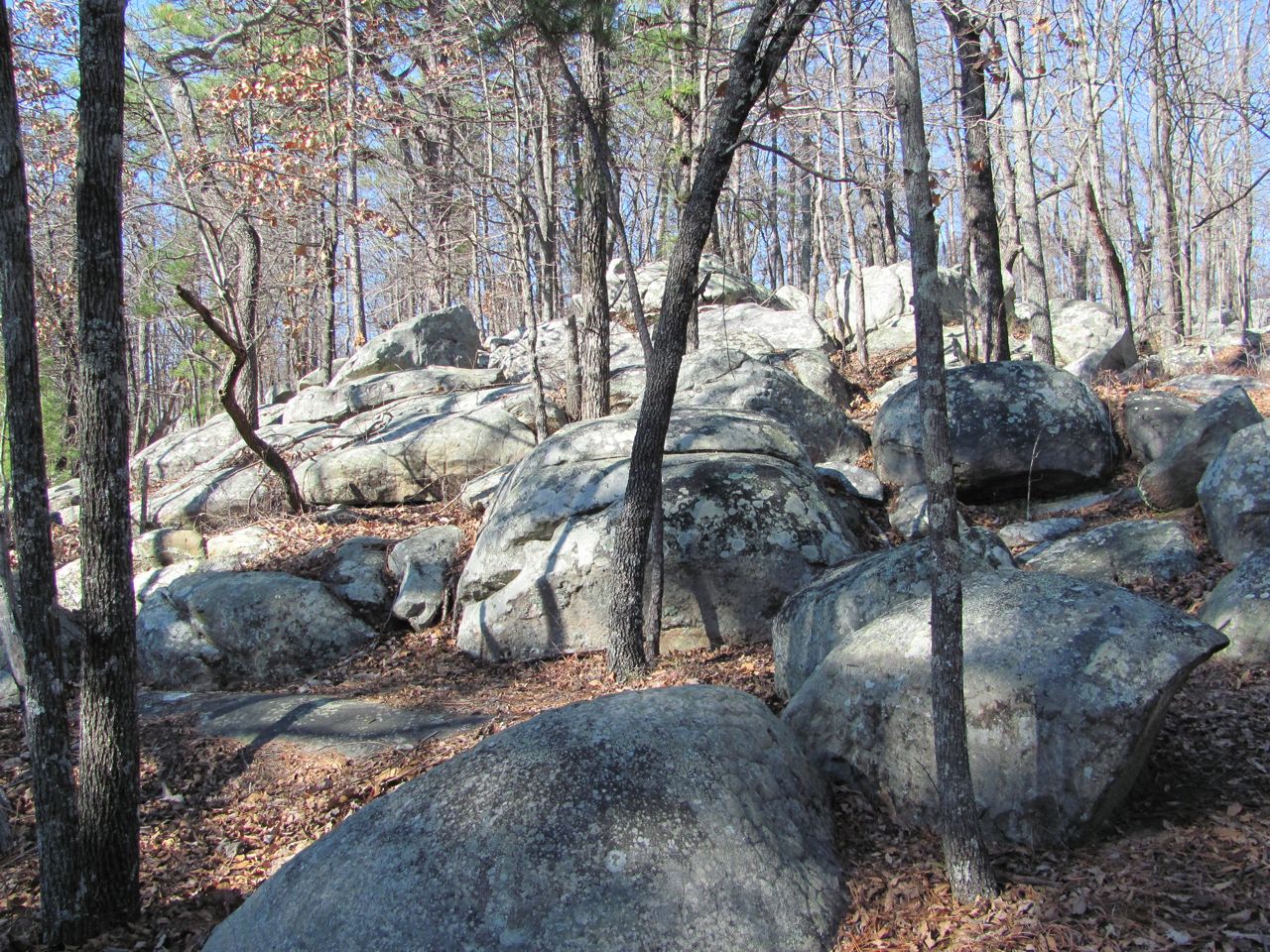
This was our last full day at Oak Mountain and I wanted to say just a couple of other things about the park. We came to hike and hike we did. We were very pleased with the trail system and the condition of the trails. There are over 50 miles of trail in the park. The bike trail and the horse trail we left for their respective users.
One thing that I haven’t mentioned at all is the number of geocaches here. There are over 55 in the park. We’re not geocache people, so weren’t interested in trying to find any, but we did stumble upon one during one of our hikes. In the interest of keeping the location a secret and not giving away any clues, I left that part out of my earlier posts. Now that there’s no way to tell where this cache is located, I’ll show you what we found. That was just a little extra treat one day.
So, we have been very impressed with this park, both with the facilities and the staff, and have enjoyed our stay. We anticipate returning many times in the future.
Yesterday, I mentioned being a type A personality. I like to make lists because I like the organization and structure it gives to my tasks. As a type A I don’t do so well with unscheduled events. We had one today that sent my little step 1, step 2, step 3 mind into a frenzy. As I came in the door from putting the last load of laundry in the drying, Gene said, “we have a problem”. Those are never good words to hear.
The problem was a tire issue. We’re planning to leave tomorrow and Gene was checking air pressure this morning when he discovered that our front passenger side tire on the motor home was 40 lbs low on air pressure. Unable to imagine any reason why the tire would have lost that much pressure during this week other than a leak, he called around to find a place to fix the tire. He finally settled on Don’s Tire about 10 miles from here. Of course, we had to take the tire to them, so we packed everything up, unhooked our life support, and drove on over to Don’s. Tim (Don was out doing other stuff) was unable to find anything wrong with the tire. So far today it has maintained its pressure. What a mystery.
That little episode took a couple hours out of my day so I didn’t get to mark off nearly as much stuff from those lists as I’d hoped. Oh well, there’s always tomorrow.
My Maineiac friend, Mike, was wondering if his name appeared on the “naughty” list. Let me just say that I’m not the keeper of that list, nor the “nice” list. I suspect everyone knows on which of those lists their name might appear. Just remember, Santa is always watching.
That’s it for tonight. Thanks for tagging along.
Wednesday, December 21, 2011
Tuesday, December 20, 2011
Making a List
This morning we did one last hike. It was the last 2.5 miles of the Yellow trail that we had not done. Since this trail meanders through the woods up and down the hills along the base of the north ridge, it’s a little more difficult to create loops. It is the longest of the hiking trails (excluding the bike and horse trails) at 8 miles. That’s too much for us to do a complete out and back. So we divided it into three different hikes. One was the short loop at the north end when we connected to the White trail. Our second hike on the Yellow trail was from Picnic Area 2 when we did two out and backs, one northbound from the picnic area and the other southbound.
Today we drove over to Group Camp Road and parked the car. There is actually not a parking lot here, but there is enough room on the side of the road to park 4 or 5 cars. We walked the short distance from the main road to the junction with the Yellow trail at the point where we had turned around on our last hike. From this starting point the trail crosses a stream on a foot bridge then climbs up the first of several hills. Much of the trail in this section shares the path with horses. For the first mile or so we saw little horse use, but the portion beyond Tranquility Road seems to be popular with the equestrians.
The trail crosses Tranquility road near the Alabama Wildlife Center and soon comes to the junction with the Treetop Nature Trail. We continued on the Yellow Trail to its end at the South Trailhead parking lot. After a short break we turned around and headed back.
There is a new connector trail which connects the Yellow and Green trails. This trail is so new it isn’t on the map yet, but in our hiking we had seen the other end at the Green trail so felt comfortable taking it on our way back. At the Green trail we were able to pick up the Treetop Nature trail and hike up the hill to connect with the Yellow just below the Wildlife Center. It cut off a couple of climbs and maybe a third of a mile on our return trip.
We’ve hiked 34.6 miles while we’ve been in this park. We’ve enjoyed it all, but it is now time to turn our attention to something entirely different. With just five more days until Christmas, I guess it’s about time I got organized. Nothing like waiting until the last minute to rev up that old Christmas spirit.
I’m one of those crazy Type A personality people and I just love lists. I love everything about lists. I love making a list and I love marking things off of the lists as I get it done. Yesterday, I worked on making lists. I have a list for who’s getting what for Christmas, a list of gifts that still need to be purchased, a cookie and candy baking list, a chore list, and the ever present grocery list. We got started on marking things off of these lists yesterday. We went out with the rest of the population of Birmingham to do Christmas shopping. Thank goodness Gene had ordered a lot online and we didn’t have many stops to make. Still the traffic was horrific and the stores were crowded. I purposefully waited for Monday morning because I had heard that is supposed to be the least crowded time of the week. Maybe that rule doesn’t apply to Monday before Christmas. We were both exhausted by the time we got home.
This afternoon and tomorrow, we’ll be staying at home working on the baking and chore lists. Thursday, we’ll be moving back to Nashville to be with family for Christmas.
Better get busy, now. Time is short. Thanks for tagging along.
Today we drove over to Group Camp Road and parked the car. There is actually not a parking lot here, but there is enough room on the side of the road to park 4 or 5 cars. We walked the short distance from the main road to the junction with the Yellow trail at the point where we had turned around on our last hike. From this starting point the trail crosses a stream on a foot bridge then climbs up the first of several hills. Much of the trail in this section shares the path with horses. For the first mile or so we saw little horse use, but the portion beyond Tranquility Road seems to be popular with the equestrians.
The trail crosses Tranquility road near the Alabama Wildlife Center and soon comes to the junction with the Treetop Nature Trail. We continued on the Yellow Trail to its end at the South Trailhead parking lot. After a short break we turned around and headed back.
There is a new connector trail which connects the Yellow and Green trails. This trail is so new it isn’t on the map yet, but in our hiking we had seen the other end at the Green trail so felt comfortable taking it on our way back. At the Green trail we were able to pick up the Treetop Nature trail and hike up the hill to connect with the Yellow just below the Wildlife Center. It cut off a couple of climbs and maybe a third of a mile on our return trip.
We’ve hiked 34.6 miles while we’ve been in this park. We’ve enjoyed it all, but it is now time to turn our attention to something entirely different. With just five more days until Christmas, I guess it’s about time I got organized. Nothing like waiting until the last minute to rev up that old Christmas spirit.
I’m one of those crazy Type A personality people and I just love lists. I love everything about lists. I love making a list and I love marking things off of the lists as I get it done. Yesterday, I worked on making lists. I have a list for who’s getting what for Christmas, a list of gifts that still need to be purchased, a cookie and candy baking list, a chore list, and the ever present grocery list. We got started on marking things off of these lists yesterday. We went out with the rest of the population of Birmingham to do Christmas shopping. Thank goodness Gene had ordered a lot online and we didn’t have many stops to make. Still the traffic was horrific and the stores were crowded. I purposefully waited for Monday morning because I had heard that is supposed to be the least crowded time of the week. Maybe that rule doesn’t apply to Monday before Christmas. We were both exhausted by the time we got home.
![]() |
| Needed a little snow to help my Christmas spirit so I found this picture from last December in Nashville. |
This afternoon and tomorrow, we’ll be staying at home working on the baking and chore lists. Thursday, we’ll be moving back to Nashville to be with family for Christmas.
Better get busy, now. Time is short. Thanks for tagging along.
Sunday, December 18, 2011
The Yellow Trail
In our hiking at Oak Mountain State Park, we have completed the Blue, White, and Green trails. Today, we did a good portion of the Yellow Trail. The name given to the Yellow Trail is Foothills Trail. That’s an appropriate name because the Yellow trail meanders up the hills and down into the ravines that skirt the North Ridge.
For today’s hike we parked at the picnic shelter at Picnic Area II and started our hike by going left toward Old Lake and then on to Maggie Glen. We retraced our steps from Maggie Glen to the picnic shelter then continued on the Yellow trail to Group Camp Rd. then back to the picnic shelter and the car. The total distance was 5.6 miles.
The first part of our hike took us upstream to the dam at Old Lake. Above the dam, the trail skirted the west side of this small lake before re-entering the woods. Gene and I agreed--the lake was our favorite part of the hike.
There was a side trail which led to the cabins on the other side of the lake, but we passed on that adventure. Not far from the lake we came to a backcountry campsite. There was a stream nearby for easy access to water, but the campsite was not level enough for our liking. After a quick inspection of the campsite we continued on to Maggie Glen.
I love this area at Maggie Glen. It is so peaceful beside the stream. Several trails intersect here, so there is a kiosk with a trail map and other information. By the kiosk are benches which made a great place to sit in the sun for our morning break. Gene, bless his heart, made hot chocolate for us.
We returned to the picnic area then continued on the Yellow trail in the other direction. For the first quarter mile or so, we followed the stream. We crossed the stream on a foot bridge and began our climb to the top of the next hill. In this section, the Yellow hiking trail is shared with horses. However, the trail is pretty steep and in places pretty narrow for horses, so we didn’t see much evidence of horse use.
Descending the other side of this hill brought us to Group Camp Road. At the intersection was another kiosk with benches--a perfect place for our lunch break. After a long break, we headed back to the car at the picnic shelter.
From where we stopped for our lunch, the Yellow trail continues with its short ups and downs for 2.5 more miles. There is a parking lot at the end of the Yellow trail. If we get an opportunity, we’ll hike this last 2.5 miles to complete all the hiking trails in the Park. Although hiking is allowed, we have not and don’t want to hike the Red trail which is used by mountain bikers. There is also an Orange Horse trail which we haven’t hiked, but we’re not too fond of horse trails.
That’s it for today. Thanks for tagging along.
![]() |
| Water coming over the Old Lake Dam |
For today’s hike we parked at the picnic shelter at Picnic Area II and started our hike by going left toward Old Lake and then on to Maggie Glen. We retraced our steps from Maggie Glen to the picnic shelter then continued on the Yellow trail to Group Camp Rd. then back to the picnic shelter and the car. The total distance was 5.6 miles.
The first part of our hike took us upstream to the dam at Old Lake. Above the dam, the trail skirted the west side of this small lake before re-entering the woods. Gene and I agreed--the lake was our favorite part of the hike.
![]() |
| At the top of the Dam |
![]() |
| Park cabins are on the other side of the lake |
There was a side trail which led to the cabins on the other side of the lake, but we passed on that adventure. Not far from the lake we came to a backcountry campsite. There was a stream nearby for easy access to water, but the campsite was not level enough for our liking. After a quick inspection of the campsite we continued on to Maggie Glen.
![]() |
| A watched pot never boils |
I love this area at Maggie Glen. It is so peaceful beside the stream. Several trails intersect here, so there is a kiosk with a trail map and other information. By the kiosk are benches which made a great place to sit in the sun for our morning break. Gene, bless his heart, made hot chocolate for us.
We returned to the picnic area then continued on the Yellow trail in the other direction. For the first quarter mile or so, we followed the stream. We crossed the stream on a foot bridge and began our climb to the top of the next hill. In this section, the Yellow hiking trail is shared with horses. However, the trail is pretty steep and in places pretty narrow for horses, so we didn’t see much evidence of horse use.
Descending the other side of this hill brought us to Group Camp Road. At the intersection was another kiosk with benches--a perfect place for our lunch break. After a long break, we headed back to the car at the picnic shelter.
From where we stopped for our lunch, the Yellow trail continues with its short ups and downs for 2.5 more miles. There is a parking lot at the end of the Yellow trail. If we get an opportunity, we’ll hike this last 2.5 miles to complete all the hiking trails in the Park. Although hiking is allowed, we have not and don’t want to hike the Red trail which is used by mountain bikers. There is also an Orange Horse trail which we haven’t hiked, but we’re not too fond of horse trails.
That’s it for today. Thanks for tagging along.
Saturday, December 17, 2011
Moccasin Wildlife Trail and Rescued Birds
We took a much needed day off from hiking yesterday to get some household chores done. Perhaps the most urgent chore was to get the laundry, especially those stinky hiking clothes. Oak Mountain State Park campground not only has pull-thru, full-hook-up sites, it also has washers and dryers in the bath houses. It’s wonderful.
Today, I was on a quest to find out where the Moccasin Trail went. This is the trail down by Beaver Lake and I had done a short walk along this trail last week. We started at the same point I had before, at the back of the B loop in the Campground. I was disappointed in not seeing the great blue heron today. The trail is easy to follow as it skirts the lake at the back of the campground. As we began to get past the campground, the trail became increasingly more faint and the footing uneven. It seemed hardly more than a fisherman’s path to a favorite spot. With no indication of how long this trail is and without blazes to mark the way, with decided to turn back.
Gene spoke with the campground manager and he indicated that the trail pretty much circles the lake. That would make it a couple or three miles in length which would be a very nice loop. I was anxious to see if I could connected the dots.
After lunch we drove up to the parking lot by the dam and went exploring. We found a path from the parking lot, but it eventually faded away and again we thought it was probably just a fisherman’s path. Back at the dam, we looked for a way to get to the other side without walking through water. Perhaps in dry weather, the road wouldn’t be flooded and it would be an easy walk to the other side. Today, however, there was water flowing over the road. It wasn’t very deep and many cars passed through, but our car is very low to the ground and we just didn’t want to do it so we don’t know whether we could have found the trail on the other side or not.
I may try walking the path again on Monday to see how far I can get. Otherwise, I may just have to abandon my efforts on this trail. Too bad, too. It has great appeal being assessable to the campground and an easy walk along the lake.
Our next stop was the lower portion of the Treetop Nature Trail. One of the objectives of the Alabama Wildlife Center, located in the Park, is to rehabilitate injured birds. They do a fantastic job and many birds are returned to the wild. However, there are birds which sustain such debilitating injuries that they can no longer survive in the wild. These birds are cared for by the staff, friends, and volunteers of the Wildlife Center and live in huge cages along this trail. It was sad, in a way to see these magnificent birds caged, but, on the other hand, they wouldn’t survive on their own. Even though we didn’t do it, this trail continues up the hill and ends at the Wildlife Center building in about a half mile.
Tomorrow, we’re going to tackle some of the Yellow Trail. We haven’t done much of it so are looking forward to something new and different.
We want to welcome our two newest followers--Teri and Hembree (2025). We’re glad to have you both tagging along.
That’s it for today. Thanks for tagging along.
Today, I was on a quest to find out where the Moccasin Trail went. This is the trail down by Beaver Lake and I had done a short walk along this trail last week. We started at the same point I had before, at the back of the B loop in the Campground. I was disappointed in not seeing the great blue heron today. The trail is easy to follow as it skirts the lake at the back of the campground. As we began to get past the campground, the trail became increasingly more faint and the footing uneven. It seemed hardly more than a fisherman’s path to a favorite spot. With no indication of how long this trail is and without blazes to mark the way, with decided to turn back.
![]() |
| Fishermen on Beaver Lake |
Gene spoke with the campground manager and he indicated that the trail pretty much circles the lake. That would make it a couple or three miles in length which would be a very nice loop. I was anxious to see if I could connected the dots.
After lunch we drove up to the parking lot by the dam and went exploring. We found a path from the parking lot, but it eventually faded away and again we thought it was probably just a fisherman’s path. Back at the dam, we looked for a way to get to the other side without walking through water. Perhaps in dry weather, the road wouldn’t be flooded and it would be an easy walk to the other side. Today, however, there was water flowing over the road. It wasn’t very deep and many cars passed through, but our car is very low to the ground and we just didn’t want to do it so we don’t know whether we could have found the trail on the other side or not.
![]() |
| Water flowing over the road at the dam. |
I may try walking the path again on Monday to see how far I can get. Otherwise, I may just have to abandon my efforts on this trail. Too bad, too. It has great appeal being assessable to the campground and an easy walk along the lake.
Our next stop was the lower portion of the Treetop Nature Trail. One of the objectives of the Alabama Wildlife Center, located in the Park, is to rehabilitate injured birds. They do a fantastic job and many birds are returned to the wild. However, there are birds which sustain such debilitating injuries that they can no longer survive in the wild. These birds are cared for by the staff, friends, and volunteers of the Wildlife Center and live in huge cages along this trail. It was sad, in a way to see these magnificent birds caged, but, on the other hand, they wouldn’t survive on their own. Even though we didn’t do it, this trail continues up the hill and ends at the Wildlife Center building in about a half mile.
Tomorrow, we’re going to tackle some of the Yellow Trail. We haven’t done much of it so are looking forward to something new and different.
We want to welcome our two newest followers--Teri and Hembree (2025). We’re glad to have you both tagging along.
That’s it for today. Thanks for tagging along.
Thursday, December 15, 2011
Blue and White, The Same Only Different
We were back out there hiking again today. That makes three days in a row. Woo-hoo. After a summer of sitting, it feels so good to be getting back into hiking shape again.
Today, we did the Blue Trail and connected with the Orange Trail to the White Trail. That sounds exactly like what we did on Tuesday except today we started at the Peavine Falls Trailhead at the south end of the park. We hiked along the Blue Trail to the Orange connector. We hiked the White Trail from the Orange Connector back to the Peavine parking lot for a 7.7 mile hike. We have now hiked all of both the Blue and White trails.
What we did today was much easier than what we had done on Tuesday. The climb up to the ridge from Peavine Falls on the Blue trail was much more gradual, plus it was 300 feet less in elevation gain. Likewise, coming off the ridge on the White trail was much shorter and less steep than on the north end of the trail. We’d rate this as a moderate hike.
The Peavine parking lot is at the end of a narrow, steep, curvy road. I wasn’t thrilled with that, but luckily we only met one car as we were going up. The parking lot is huge. Peavine Falls is a popular place and is only a half mile walk from the parking lot. There is a port-a-potty and a picnic pavilion, but no changing room. Three trails lead from this parking lot--the Green, White, and Blue. Actually, you follow the White to connect with the Blue at the falls.
As we walked by the falls this morning, we kept glancing over from different vantage points, but had no better views then we did the other day. There were two different trails that lead down to the base of the falls, but there were signs everywhere warning of the hazardous conditions. We decided to leave all that to those younger and braver.
Although other trails were in close proximity, this hike seemed much more remote than the others we’ve done in this park. Perhaps it was because it was a cloudy day and we saw no one else on the trail. Of these two trails, I found the White trail to be much more interesting to hike. I liked the narrow ridge top section of the White trail better than the ridge walk on the Blue trail and I especially liked the last couple miles of the White trail as it followed alongside Peavine Branch.
Tomorrow we’re going to take a day off from hiking. I’ve been asked to write a few hike descriptions for the campground and I need to get that done before I forget what I did. This little project came about sorta as a result of our electrical failure. When the guys were here working on our electricity, Gene gave each of them one of our cards which has our names and blog address. One of those cards got into the hands of the campground manager, he read the blog, like the trail descriptions I had written, and asked if I would be interested in writing up a few hikes. What he has in mind is to have a list of hikes with short descriptions that can be handed out to campers who inquire about hiking. Anyway, when I said I’d be willing to do that, he consulted the park superintendent who also liked the idea--liked it so much he offered us two weeks of free camping. We couldn’t believe it. That is so generous. Thank you very much.
That’s it for today. Thanks for tagging along.
![]() |
| The White Trail is wide and flat as it leaves the Peavine Falls parking lot. |
Today, we did the Blue Trail and connected with the Orange Trail to the White Trail. That sounds exactly like what we did on Tuesday except today we started at the Peavine Falls Trailhead at the south end of the park. We hiked along the Blue Trail to the Orange connector. We hiked the White Trail from the Orange Connector back to the Peavine parking lot for a 7.7 mile hike. We have now hiked all of both the Blue and White trails.
![]() |
| This looks like a good spot for our morning break. |
What we did today was much easier than what we had done on Tuesday. The climb up to the ridge from Peavine Falls on the Blue trail was much more gradual, plus it was 300 feet less in elevation gain. Likewise, coming off the ridge on the White trail was much shorter and less steep than on the north end of the trail. We’d rate this as a moderate hike.
![]() |
| Long leaf pine starts out with a grass-like phase. It does grow tall, but concentrates on making it stem thicker and developing a taproot. |
The Peavine parking lot is at the end of a narrow, steep, curvy road. I wasn’t thrilled with that, but luckily we only met one car as we were going up. The parking lot is huge. Peavine Falls is a popular place and is only a half mile walk from the parking lot. There is a port-a-potty and a picnic pavilion, but no changing room. Three trails lead from this parking lot--the Green, White, and Blue. Actually, you follow the White to connect with the Blue at the falls.
![]() |
| We aren't sure what this red bush is. It looks a little like low bush blueberry. |
As we walked by the falls this morning, we kept glancing over from different vantage points, but had no better views then we did the other day. There were two different trails that lead down to the base of the falls, but there were signs everywhere warning of the hazardous conditions. We decided to leave all that to those younger and braver.
![]() |
| There's still a few leaves out there, but precious few. |
Although other trails were in close proximity, this hike seemed much more remote than the others we’ve done in this park. Perhaps it was because it was a cloudy day and we saw no one else on the trail. Of these two trails, I found the White trail to be much more interesting to hike. I liked the narrow ridge top section of the White trail better than the ridge walk on the Blue trail and I especially liked the last couple miles of the White trail as it followed alongside Peavine Branch.
Tomorrow we’re going to take a day off from hiking. I’ve been asked to write a few hike descriptions for the campground and I need to get that done before I forget what I did. This little project came about sorta as a result of our electrical failure. When the guys were here working on our electricity, Gene gave each of them one of our cards which has our names and blog address. One of those cards got into the hands of the campground manager, he read the blog, like the trail descriptions I had written, and asked if I would be interested in writing up a few hikes. What he has in mind is to have a list of hikes with short descriptions that can be handed out to campers who inquire about hiking. Anyway, when I said I’d be willing to do that, he consulted the park superintendent who also liked the idea--liked it so much he offered us two weeks of free camping. We couldn’t believe it. That is so generous. Thank you very much.
That’s it for today. Thanks for tagging along.
Wednesday, December 14, 2011
An Easy Day
Even with a good night’s sleep we weren’t too perky this morning, so it felt real good to sit around sipping coffee, leisurely going about morning chores, and just enjoying the beginning of another beautiful day. Midmorning we drove over to Publix to pick up a few things I forgot on my last grocery outing and on the way home we filled up the car and got a sandwich at Chick-fil-A.
Early this morning I made a pan of brownies for those guys that worked so hard on our electrical disaster. We drove over to deliver brownies to the work camper on our way to the grocery, but as it turned out he is off for the rest of the week and is out of the park until Sunday. Then we started looking for the maintenance guy. We found the maintenance department over by the golf course and just pulled into the parking lot. Gene asked the first person he saw. That person turned out to be supervisor and knew exactly where our man could be found--in the campground.
We couldn’t let this beautiful day get by without going for a short hike. After lunch we walked over to the Yellow trail just past the entrance to the campground. This short piece of the Yellow Trail goes right down to the North Trailhead parking lot. We continued on the Yellow Trail until it intersected with the White Trail. We came back on the White trail even though we had hiked this section of the White Trail just yesterday. It made a very nice 3-mile loop and we didn’t have to drive the car to a trailhead. How convenient is that?
Being back at the parking lot where that nice changing booth is located, I just had to make a photo. I hope this idea catches on at trailhead all across America.
It looks like this great weather is going to hold out for one more day. Can’t waste that, so will probably hike the south end of the Blue and White trails tomorrow. It’ll be another 7 mile day, but this end of the trail doesn’t climb as much nor as steeply as the north end.
That’s all for today. Thanks for tagging along.
Early this morning I made a pan of brownies for those guys that worked so hard on our electrical disaster. We drove over to deliver brownies to the work camper on our way to the grocery, but as it turned out he is off for the rest of the week and is out of the park until Sunday. Then we started looking for the maintenance guy. We found the maintenance department over by the golf course and just pulled into the parking lot. Gene asked the first person he saw. That person turned out to be supervisor and knew exactly where our man could be found--in the campground.
![]() |
| Very nice section of the Yellow Trail as it passes through a forest of long leaf pine. |
We couldn’t let this beautiful day get by without going for a short hike. After lunch we walked over to the Yellow trail just past the entrance to the campground. This short piece of the Yellow Trail goes right down to the North Trailhead parking lot. We continued on the Yellow Trail until it intersected with the White Trail. We came back on the White trail even though we had hiked this section of the White Trail just yesterday. It made a very nice 3-mile loop and we didn’t have to drive the car to a trailhead. How convenient is that?
![]() |
| These posts are all along the trails at quarter mile intervals. They make it easy to tell how far you've come and how far you have to go. |
Being back at the parking lot where that nice changing booth is located, I just had to make a photo. I hope this idea catches on at trailhead all across America.
![]() |
| I just love this. |
It looks like this great weather is going to hold out for one more day. Can’t waste that, so will probably hike the south end of the Blue and White trails tomorrow. It’ll be another 7 mile day, but this end of the trail doesn’t climb as much nor as steeply as the north end.
That’s all for today. Thanks for tagging along.
Tuesday, December 13, 2011
Blue and White Loop Hike
We were out there doing it today and I have the sore body to prove it. After due deliberation over the map, we put together a 6.5 mile loop starting on the Blue Trail and crossing over to the White Trail via the Orange connector. I suppose if you’re color blind, you could be in deep dodo.
For this hike we used the north trailhead. The Blue, Red, White, and Yellow trails all start from here so the parking lot is huge. If that lot is full, there’s an overflow lot. This parking lot has something I’ve never seen before at a trailhead, and I just have to mention it--a changing room. After a hike I’m always anxious to get out of wet, sweaty clothes. I have done contortion acts in the front seat of the car trying to change into dry clothes. I was very impressed to see this little changing area. It’s brand new; in fact, they were working on it this afternoon when we got back to the parking lot. Looks for all the world like another Eagle scout project.
As you can see from the trail profile, we had a climb right from the beginning. There were three stream crossings pretty soon after we started, but they were just trickles that could be easily stepped over. Just before the one mile mark there is a side trail to Eagle’s Nest Overlook. Being up pretty high, we thought there would be a good view, so we took the very, very steep quarter mile side trail to the overlook. To our disappointment, there was a huge boulder at the overlook which completely blocked the view unless you wanted to climb to the top of the boulder. Thanks, but no thanks.
Back on the Blue Trail we continued our climb to the ridge. Once on the top, it was easy going until we intersected with the Orange Connector. We passed trails to overlooks, but we didn’t fall for that trick every time. We did take one side trail over to the edge of the ridge, but the view was obstructed by trees. At the Orange Connector we stopped for our lunch break. It was such a beautiful day and so warm in the sun that we actually stretched out on the ground for a few minutes. Well, Gene was on the ground, I was on may clean and dry poncho.
The Orange Connector took us off the ridge top, past the red trail, and over to the next ridge and the White Trail. I think the hike along the ridge on the White Trail was a nicer hike than along the ridge on the Blue Trail. The White Trail followed a very narrow ridge line, passing over our highest elevation of the day at 1286 ft, until it dropped off into the holler (that’s a real southern word for you). After about a mile of almost vertical descent, we found ourselves at Peavine Branch in Maggie’s Glen. From there it was an easy walk out to the parking lot.
Now for something all together different--electricity. Emma’s mama, Judy, asked if we used a surge protector and if it had protected our rig. No, we don’t have a surge protector. I know, lots of folks out there recommend having one. From what I understand about electricity (and that’s very, very little), that for our 30 amp rig, we plug into the 30 amp outlet, and that’s what we get. There is no more than 30 amps of electricity going to come through that outlet unless something bad happens at the utility or if lightning strikes a wire or a transformer or something. My understanding is that surges can also occur within the RV from large appliances turning on and off.
So, a surge protector that plugs into the post at the campsite might protect against the lightning strike or the disaster at the utility company. It seems to me the real danger is from those surges which occur inside the RV which are on the other side of that surge protector at the post. There are probably few people in America that don’t have surge protectors on their computers. For us, because we have so few electrical outlets and because of their locations, we have those extension cord/surge protectors all over our RV. The only things not plugged into one are the microwave, refrigerator, AC, and the small TV in the bedroom.
In the incident on Monday, that was not a surge. There was a short, either in our plug or in the campground post, which caused the problem. If the problem had been in the post and If we had had a surge protector plugged into the outlet, the surge protector would have been fried but would have protected our electrical cord (I think). However, it only cost $18 for a new end on our cord and a new surge protector would have been much more than that.
Just one other thing for completeness sake. We have one of those small testers which measures voltage and frequency. Gene always tests the electrical post before plugging our rig into the outlet. Then we plug the tester into an outlet inside the rig and leave it plugged in. It will alarm if the voltage is either too low or too high. We’ve never had a too high alarm in the 6 years we’ve been RVing. We’ve had low voltage occasionally, usually during the summer about dinner time when everybody has their ACs cranked up to very cold.
Hope that helps, Judy. I think that’s more than I really know about electricity anyway.
I also got a comment from that Maineiac in Motion, Mike, who suggested I use some other term besides “melt down”. From a man who spent his career in nuclear energy, I guess “melt down” is a pretty scary term.
That’s it from me for today. Thanks for tagging along.
For this hike we used the north trailhead. The Blue, Red, White, and Yellow trails all start from here so the parking lot is huge. If that lot is full, there’s an overflow lot. This parking lot has something I’ve never seen before at a trailhead, and I just have to mention it--a changing room. After a hike I’m always anxious to get out of wet, sweaty clothes. I have done contortion acts in the front seat of the car trying to change into dry clothes. I was very impressed to see this little changing area. It’s brand new; in fact, they were working on it this afternoon when we got back to the parking lot. Looks for all the world like another Eagle scout project.
As you can see from the trail profile, we had a climb right from the beginning. There were three stream crossings pretty soon after we started, but they were just trickles that could be easily stepped over. Just before the one mile mark there is a side trail to Eagle’s Nest Overlook. Being up pretty high, we thought there would be a good view, so we took the very, very steep quarter mile side trail to the overlook. To our disappointment, there was a huge boulder at the overlook which completely blocked the view unless you wanted to climb to the top of the boulder. Thanks, but no thanks.
![]() |
| This rock was in the way of my view. |
Back on the Blue Trail we continued our climb to the ridge. Once on the top, it was easy going until we intersected with the Orange Connector. We passed trails to overlooks, but we didn’t fall for that trick every time. We did take one side trail over to the edge of the ridge, but the view was obstructed by trees. At the Orange Connector we stopped for our lunch break. It was such a beautiful day and so warm in the sun that we actually stretched out on the ground for a few minutes. Well, Gene was on the ground, I was on may clean and dry poncho.
![]() |
| We passed this backcountry campsite on the Orange Connector. |
![]() |
| Lots of stuff to look at at the intersection where the Orange and Red trails intersected. |
The Orange Connector took us off the ridge top, past the red trail, and over to the next ridge and the White Trail. I think the hike along the ridge on the White Trail was a nicer hike than along the ridge on the Blue Trail. The White Trail followed a very narrow ridge line, passing over our highest elevation of the day at 1286 ft, until it dropped off into the holler (that’s a real southern word for you). After about a mile of almost vertical descent, we found ourselves at Peavine Branch in Maggie’s Glen. From there it was an easy walk out to the parking lot.
![]() |
| Found this boulder field on the Orange Connector |
![]() |
| I enjoyed this ridge walk on the White trail |
Now for something all together different--electricity. Emma’s mama, Judy, asked if we used a surge protector and if it had protected our rig. No, we don’t have a surge protector. I know, lots of folks out there recommend having one. From what I understand about electricity (and that’s very, very little), that for our 30 amp rig, we plug into the 30 amp outlet, and that’s what we get. There is no more than 30 amps of electricity going to come through that outlet unless something bad happens at the utility or if lightning strikes a wire or a transformer or something. My understanding is that surges can also occur within the RV from large appliances turning on and off.
So, a surge protector that plugs into the post at the campsite might protect against the lightning strike or the disaster at the utility company. It seems to me the real danger is from those surges which occur inside the RV which are on the other side of that surge protector at the post. There are probably few people in America that don’t have surge protectors on their computers. For us, because we have so few electrical outlets and because of their locations, we have those extension cord/surge protectors all over our RV. The only things not plugged into one are the microwave, refrigerator, AC, and the small TV in the bedroom.
In the incident on Monday, that was not a surge. There was a short, either in our plug or in the campground post, which caused the problem. If the problem had been in the post and If we had had a surge protector plugged into the outlet, the surge protector would have been fried but would have protected our electrical cord (I think). However, it only cost $18 for a new end on our cord and a new surge protector would have been much more than that.
Just one other thing for completeness sake. We have one of those small testers which measures voltage and frequency. Gene always tests the electrical post before plugging our rig into the outlet. Then we plug the tester into an outlet inside the rig and leave it plugged in. It will alarm if the voltage is either too low or too high. We’ve never had a too high alarm in the 6 years we’ve been RVing. We’ve had low voltage occasionally, usually during the summer about dinner time when everybody has their ACs cranked up to very cold.
Hope that helps, Judy. I think that’s more than I really know about electricity anyway.
I also got a comment from that Maineiac in Motion, Mike, who suggested I use some other term besides “melt down”. From a man who spent his career in nuclear energy, I guess “melt down” is a pretty scary term.
That’s it from me for today. Thanks for tagging along.
Subscribe to:
Posts (Atom)