Tuesday, October 18, 2011

A Day in Greenville, South Carolina

Before I get started with my adventure, I want to say Happy Birthday to our son-in-law, Jack.  He and Kayley share the 18th as their birthdays.  This is not a very good picture of Jack, but you know who gets all the attention anyway.  Happy Birthday, Jack.  You’re the best.

Mom and I had a full day in the car yesterday as we drove to Greenville.  It was not a bad drive.  The weather was wonderful, the traffic was light, and I-40 all the way from Nashville to Ashville was in excellent condition.  We encountered no areas of construction and no slowdowns, not even in Knoxville.

We were hoping for some brilliant fall color as we crossed the mountains, but no such luck.  The yellows are starting to change, but there were hardly any reds.  Mostly, it seemed a bit dull, sorta like the leaves were just dying and falling off the trees, perhaps from lack of rain.  Tennessee has been very dry for the past few months.

We finally arrived at my uncle’s home just in time for dinner.  And, oh boy, was it ever a good dinner.  He had made a wonderful chicken casserole, green bean casserole, fresh corn on the cob, and a yummy cherry congealed salad.  I hope we convinced him to bring his speciality--chocolate pecan pie--to Nashville for Thanksgiving dinner.  Also around the table sharing this wonderful meal were Carl’s two sons and daughter-in-law.  It was a great visit.

Today, we went downtown for a short walk around Falls Park.  The Reedy River runs through the downtown area and the city has created a fabulous green space along the river bank with gardens of flowers and a paved walkway for walkers, joggers, and bicyclists.

We stopped on Main Street at Mast General Store.  I had been in the Mast General in Ashville, but never this store.  It's always fun.  I especially like the "housewares" section with the barrels of candy.


After lunch we drove over to Furman University for a tour around that beautiful campus.  We were lucky enough to see the black swan on the lake.  My mom tires easily so we passed on walking along the paved trail around the lake.
Bell Tower and Lake at Furman University

The highest point around the city is Paris Mountain.  We drove up there for the view.  It’s impressive to see the city far below.  Unfortunately, by the time we were there the clouds were beginning to move in and our view wasn’t as good as it could have been.

It’s been a very full day and we’re looking forward to another one tomorrow.

That’s it for now.  Thanks for tagging along.

Sunday, October 16, 2011

Ready for a Road Trip

We had a fine birthday celebration for our granddaughter, Kayley, Saturday afternoon.  It was fun to see her playing with her little friends.  It was also nice to see other grandparents and great grandparents; many we don’t see very often.  It’s hard to believe she’s two already.

I have been adding a few features to the blog.  Near the top of the page you may have noticed the “Our Story”, “Full-Time RVing”, and “Living in a Class C” tab.  Those have all been added during the past few days.

Slowly but surely I’ve been adding the blogs which I follow.  I certainly appreciate those following this blog.  I know we have many regular readers not following publicly. We appreciate all our readers and your support.  It really makes writing the blog much more fulfilling.

As I’ve been experimenting and playing around with Blogger, I keep finding features that I really like.  Many of these features don’t exist on Trip Journal or, if they do, they’re easier to use on Blogger.

I’ve been packing my suitcase this afternoon.  Whenever that happens, it’s such a strange experience.  We travel all the time, but since we take everything we own with us, it seems so odd to pick out the stuff needed for a few days away from home.  We do this so seldom, we usually spend more time trying to remember where the suitcase is than we spend packing.

What’s the destination?  Well, Greenville, South Carolina, off course.  My mother and I are taking this little three-day trip without our husbands.  Just us girls.  My mother’s brother lives in Greenville and we’re going to visit with him for a few days.

A “girls trip” is not unusual for mom and I.  As a teenager, she and I would come to Nashville for a shopping day.  After I grew up, we expanded on our shopping trips and often got on a plane to Chicago for shopping on the Magnificent Mile.  More often than that, we’d get in the car and drive to Atlanta.  These shopping trips were a special time for mom and I.

Health issues for her and full-time RVing for me has interfered with these trips.  Our last shopping spree was to Chicago for my 50th birthday over 10 years ago.

So, when she suggested we go for a visit with her brother, I couldn’t think of anything better to do.  Well, I probably could have, but nothing that would be as important or mean as much to us both.

This afternoon we went to the grocery to get some grub for Gene.  Hopefully, he hasn’t completely forgotten how to cook.  If things get too bad, he can always find his way to Cracker Barrel down the street.  The Peanut knows how to let you know when he’s hungry and we got plenty of cat food at the grocery, too.

That’s what we’ve been up to.  Thanks for tagging along.
Saturday, October 15, 2011

Fiery Gizzard Trail

Friday, we drove about a hundred miles down to South Cumberland State Park.  I always think of it being “down” since it is southeast of Nashville, but it is actually up--up on the Cumberland Plateau at Monteagle.

South Cumberland State Park is unique in that it doesn’t exist as a single unit, but has ten sections spread out over a hundred square miles in four different counties. The Visitor Center is located between Monteagle and Tracy City on Highway 41.  That’s were we stopped first to pick up a trial map.
Slippery rock steps lead into the gorge.

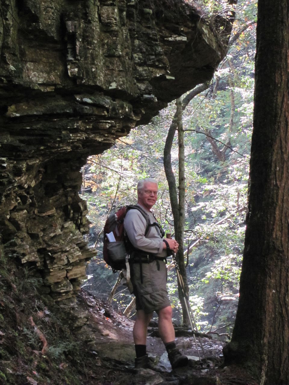
There are many trails within South Cumberland.  We chose Fiery Gizzard since the trailhead was only about 3 miles from the Visitor Center.  Fiery Gizzard is a linear trial of about 13 miles.  We didn’t have a second car to run a shuttle nor did we want to hike 26 miles, so we opted to take Fiery Gizzard into the gorge 1.5 miles to the Dog Hole Trail. Dog Hole climbes out of the gorge and runs along the rim on the plateau for 2.8 miles before intersecting with Fiery Gizzard where it comes out of the gorge.  For our return to the trailhead, we took Fiery Gizzard back into the gorge for the 4.6 miles walk to the car. Of course, we had to climb out of the gorge one more time to the parking lot.

It has been about 10 years since we’d done this trail.  As we were doing it Friday, we remembered why we don’t come here often.  We’d rate the Fiery Gizzard trail as very difficult.  The first 1.5 miles is treterous over slippery roots, but has several boardwalks and a couple bridges over wet areas.  Between the junction with the Dog Hole trail and the top of the gorge, Fiery Gizzard is extremely rocky and steep.  Not all the rocks are wobbly, just the ones you step on.  I fell twice and Gene fell once.  Thankfully, nothing was broken.


Despite the difficulty, this is a popular trail.  I’ve done it several times with Tennessee Trails Association.  The big draw is the water.  The Fiery Gizzard follows the Little and Big Fiery Gizzard Creeks which offer many cascades, water falls, and swimming holes to enjoy.  Because of the numerous swimming opportunities, it’s a crowded trail during the summer months.  Today, however, we only saw one other couple.
Old coal mine entrance.
The trail was well marked, but we always have along a map and compass.


The Dog Hole trail was an easy walk across the plateau and it’s climb out of the gorge was not so steep nor rocky.  The plant life is not as diverse on the plateau as in the gorge and you certainly don’t have all that water, but the overlooks are spectacular.  We really should have come back the way we went in.

Our 8.6 mile hike took 7.5 hours and we were scurrying to get out before dark.  The three miles of rocks took an incrediable amount of time to traverse.

Back at the car (and I was so glad to see the car) we changed into dry clothes, stopped at the first Subway we came to for a sandwich, and started the long drive home.  We practically fell into bed.  Surprisingly, we’re not so sore as we expected this morning.
Backcountry campsite at Raven Point; logs around a fire ring.

BTW, legend has it that Fiery Gizzard gets its name from a tale of Davey Crockett, who, while eating turkey with a group of Indians near here, burned his mouth on a hot gizzard.
Rock formations offered a look at limestone layers.

Now, we’re off to celebrate our granddaughter’s second birthday.  Happy birthday, Kayley.

Thanks for tagging along.

Wednesday, October 12, 2011

Radnor Lake State Natural Area

One of the real gems in our city is Radnor Lake State Natural Area. Located on the south side of town among the bustling areas of Brentwood, Oak Hills, and Green Hills, this 750 acre park is Tennessee’s first State Natural Area.

The lake was impounded in 1914 by the Louisville and Nashville Railroad to provide a source of water for its steam engines.  Radnor Yards was located in the area as well at that time and the lake was to provide water for the livestock.  The railroad executives also saw it as a private hunting and fishing preserve.  What no one planned on were the birds that looked down from their migratory paths and saw a lake.  In less than ten years, the area was off limits to hunters and fishermen and became a wildlife sanctuary.

The area remained virtually untouched and unnoticed until the early 1960s when the land was purchased for a housing development.  That idea was quickly shot down by concerned local citizens.  In the early 1970s funds were raised to purchase the property and the state’s first natural area was born.

Today, Radnor is used primarily by hikers, birders, photographers, and naturalists.  Being a natural area, there are no bikes, pets, or jogging allowed on the trails.  There’s also no picnicking allowed nor off trail hiking.  That’s not to say it’s a wilderness area.  Certainly not.  There are plenty of wooden steps, bridges, and benches along the trails to make hiking and walking a pleasant experience.

Up until about 15 years ago, Otter Creek Road ran through the park.  The shoulders of the road were badly deteriorated and the road was closed to motorized traffic.  Although the road is only about a mile and a half long, it’s still a favorite place for bicyclists, dog walkers, and young mothers with strollers.  Joggers are often seen running the road, as well.

There are several options for hikes here.  For our hike today we chose to park at the East parking lot and walked the access trail to the Lake Trail.  By walking a short distance along the road we were then able to connect to the South Lake trail.  After about a mile on the South Lake Trail we did another short section of road, crossed the gravel walkway across the dam which put us back on the other end of the Lake Trail.  Because a bathroom break is always a good choice, we took the Spillway trail to the Nature Center.
The Nature Center

Unfortunately for us, the restrooms were out of order.  Fortunately for us, it was just outside the Nature Center were we saw the beautiful barred owl.  I’d heard there was an owl living here, but I’d never been lucky enough to see him.  Today he perched on the limb and posed for photos until I was tired and walked away.  Then he posed for the next photographer.  Wow, what a treat.

Since the restrooms were closed, we had to hurry right along back to the East parking lot.  For the return trip we walked along the Lake Trail then took the Ganier Ridge trail up and over the hill back to the access trail and the parking lot for a 4.6 mile loop hike.  Thankfully, those restrooms were open.
View of the lake from South Lake Trail

Gene had some birthday money burning a hole in his pocket, so after our hike we stopped in at REI.  We have friends who work at REI and we got to see two of them today.  It was fun talking to Missing Link.  He has just completed a section hike of the Appalachian Trail.  He was out for a few weeks doing the Whites in New Hampshire and the entire length of the trail in Maine.  Also had a good conversation with my friend, Sue.  Like me, she’s trying to hike all the trails in the Smokies.  It was fun catching up on what she’s done and how much we each are still lacking.

That’s been our day.  Hope yours was as much fun.

Thanks for tagging along.

Tuesday, October 11, 2011

Exploring the Unknown

Well, this should be a real adventure.  I feel like I’ve set off into uncharted waters.  Even though I’ve been following many blogs at Blogspot, and I’ve been practicing for several days, this is all pretty new and different.  I’m still working on the page so don’t be surprised to see changes.

Thanks again to everyone who made comments or suggestions.  Those comments were all encouraging.  Rick (Rick & Paulette’s RV Journal) was immensely helpful and he didn’t even know it.  His extensive knowledge of everything technology and his specific posts and articles regarding Blogger were invaluable.  I regularly read several blogs posted on Blogger.  I’ve studied every detail of every one of those blogs.  You have all been a great help.  Thanks a million.

To get me away from the computer, we went for our morning stroll.  Today found us back on the Two Rivers section of the Nashville Greenway.  We parked at Wave Country where we’ve been parking to walk the Shelby Bottoms section.  Today, however, we went the other direction, over the hill, down by McGavock High School and up to Two Rivers Middle School.  That’s where we left the Greenway to explore the unknown.  We turned down a paved road just before the Middle School property.  That lead to the small Two Rivers Lake.  Beyond the lake was Two Rivers Golf Course.  The road came to a dead end so we backtracked to the Greenway.

At the Two Rivers Park Trailhead there is a dirt trail which leads off the Greenway--McGavock Spring House Trail.  Whenever we walk this section, we pass that sign, but have never taken the leap and turned down the trail.  Today we did.  That was more uncharted territory.

Except for the sign by the greenway, the trail is unmarked.  It’s definitely a trail and easy to follow.  However, it hasn’t been maintained recently.  Once we were away from the trailhead, the dirt path became narrow and nearly overgrown.  There were two blowdowns which had to be climbed over.  The trial drops quickly and is really too steep for the tennis shoes we were wearing.  Needed boots for this one and maybe even a trekking pole.

At the bottom of the hill we came to a rickety old bridge.  I let Gene cross first.  It’s our guess that this was the location of the spring house.  Of course, there’s no sign of it now; it’s long gone.  The trail continued on until it came to the lake and the road we’d been on.  We opted to take the road back to avoid crawling over the blowdowns and the steep hill.

The McGavock Spring was the water source for Two Rivers Mansion which is just up the hill.  The mansion was built in the late 1850s by David McGavock and three generations of McGavocks lived in this splendid old house until the mid 1960s.

The junction of the Stones River and the Cumberland River is just a short distance away which probably accounts for the name--Two Rivers Mansion.  Today, the mansion and the property surrounding it are owned by Metro Parks.  The mansion is used for special park events and can also be rented for weddings and such.

That’s about all the unknown I want to explore for one day.

Thanks for tagging along.

Monday, October 10, 2011

Another Round at Beaman Park

Thanks, everyone, for you comments on the blog layout on Blogger.  The comments were all positive and very helpful.  As you might expect, Gene had a few comments of his own.  They were positive, as well.  Bless his heart, he’s had to endure my thinking out loud throughout this process.  I’m still fiddling around with it, but unless I have a major shift in thinking, I expect I’ll be moving to Blogger.  By the way, I’ve posted this story to the Blue Roads to Hiking Trails page also.

We were looking for a short hike somewhere nearby for this morning.  We chose Beaman Park again.  We parked at the lower parking lot and did the Creekside Trail loop.  Off of the loop along the banks of Henry Creek is a 0.6 mile side trail which leads to the Nature/Visitor Center.  We went over there hoping to see some nice fall colors from the boardwalk.  The leaves are definitely changing, but we’re not there yet.

We back tracked to return to the Creekside trail and then continued our loop.  When we got to the Ridgetop trail we were feeling pretty good and it wasn’t even eleven o’clock yet so we added another short 1-mile loop.  That gave us a total of 4.2 miles for today with two hills to climb--just what we needed.

I had pulled something in my knee on Friday at Mammoth Cave as I stepped up on a rock.  That’s been giving me fits all weekend, but I was very pleased today that whatever I did seems to have healed itself.  My knee felt good today as long as I didn’t try to make a crazy step.

The asters and goldenrod are still hanging on, but there’s not much else out there in the line of wildflowers.  The only other thing we saw was hearts-a-bursting which is very common around here and turtlehead which is not so common.  We keep a rough log in the flower book of what we see.  The last time we saw turtlehead was in 2006 on the trail to Zealand Hut in the White Mountains.

We saw one snake, but he was small enough to have been a worm.  Definitely a snake, though.  I thought he was dead since he was on his back with an orange belly to the sun, but when I started to move the leaves around, his tail swished around.  I still think he was all but dead.  What self-respecting snake lies on its back?

Gene is happy to report that the motor home and the car are both waxed.  I’m here to say they look mighty fine.  He’ll be cleaning his basement storage compartments next.  I think I’m done inside.  Gene really helped me out on Saturday by taking all the light fixture covers off and washing them.

I think that’s all I know for today.  Thanks for tagging along.

Sunday, October 9, 2011

Hiking at Mammoth Cave National Park

Usually when people think about Mammoth Cave National Park they think about the underground caverns.  And rightly so since Mammoth Cave is the most extensive cave system on earth.  However, there is a lot above ground as well.  The 53,000 surface acres offer a place for camping, canoeing, kayaking, bicycling, hiking, horseback riding, and auto touring.  We, of course, are interested in the trails and we went there today for a hike.

With about 60 miles of trail in the park, we had many to choose from.  There are horse trails, bike trails, and hiking trails.  Since hikers are allowed on all the trails, we selected Good Spring Loop trail which is actually a horse trail.  The loop is about 7.5 miles over gently rolling hills through primarily hardwood forest which gave us a good workout.

We haven’t been to Mammoth Cave in several years, probably about 10.  We didn’t have a trail map and couldn’t remember many details about the park, so our first stop was at the Visitor Center.  We were surprised to see a new Visitor Center under construction.  Only one wing is left to be completed; the main building was open.  It’s very nice.  The old building, as I recall, was way past it’s prime.  We picked up a trail map and were on our way.

Parking for our trail was at Good Spring Church.  To get there we had to first catch the ferry across the Green River.  At the end of the paved road we had about a mile of gravel road before getting to the church parking area.

Good Spring Baptist Church is still in use today with worship services, homecomings, and other special events.  It was reminiscent of the pioneer churches within Smoky Mountain National Park, especially in the Cade’s Cove area.  These churches were here long before the parks were parks and many of them like Good Spring Church still serve the descendants of those original members.

We finally got on the trail about 10 AM.  Being a horse trail, we had to be careful where we put our feet and like most horse trails, it was pretty beat up in places.  Because there hasn’t been any rain for several days, the trail was dry even in these spots that would normally be a mud pit.  Even the creeks were nearly dry.

We walked the first mile and a half without seeing another soul.  We stopped for a break and the late starters caught up with us.  But they weren’t hikers--they were horseback riders.  Altogether today we saw about 30 horses.  We were shocked that so many people were out.  Of course, it was a beautiful day.  Still, we had no idea the trails here had become so popular.

We were glad we went.  It was 97 miles from our campsite to the trailhead.  That’s a long way to drive for a 7 mile hike, especially on a horse trail.  But the drive was fast along I-65, the traffic was light, and it was some place different to go.  The scenery and terrain were not that different from what we have right here in Nashville at Warner Parks, but it seemed more like a real outing because we got out of town.  We had a great day.

That’s it for today.  Thanks for tagging along.