Tuesday, April 17, 2012

Rest for the Weary

After many miles of hiking last week we were more than ready for a little rest.  I think we may have pushed ourselves a little too hard on these mountain trails.  Even though we did a lot of hiking in Florida, it was flat and easy and we didn’t build up the strength and endurance we need for the mountains.

We both stumbled around Monday morning like we were about 90 years old.  By the afternoon we had perked up some, but, I have to admit, looking forward to another day of rest.  Needless to say, we were pretty sedentary (couch potatoes) most of the day.
Old Time Music sculpture on Main Street

That’s not to say we did nothing.  We made a run to Wal-Mart and on our way back drove through downtown Waynesville.  This is a nice little community of about 9,000 and serves as the county seat for Haywood County.  The town is large enough to have several restaurant chains, a couple large groceries, and a hospital.

The downtown Main Street area is nice with several upscale boutiques, speciality shops, and galleries for local artists.  We strolled along window shopping until we got to Mast General Store.  There we went inside.  I had in mind to purchase a couple throw rugs I has seen a few days ago, but alas they had been sold.  We looked around, but didn’t find anything that needed to come home with us.

Also nearby is Maggie Valley.  This small community is more like a tourists destination for folks visiting the National Park.  It’s picturesque and has the customary tee-shirt, fudge, and ice cream shops.  We stopped in one of the ice cream shops the other day with Sharon.  By our calculations we had done enough hiking to justify ice cream.

Speaking of Sharon, we thoroughly enjoyed having her along on our hikes last week.  She is a native of the area and has lived in these mountains all her life.  She was a wealth of information when we were planning our hikes.  We initially met through the blog.  We first met in person and hiked with Sharon last fall at Long Hunter State Park near Nashville.
One of the Boyd Mountain Cabins

And another
To make our hiking together convenient, she took the week away from home and stayed at Boyd Mountain cabins just down the road from our campground.  The owners had a Christmas tree farm before they got into the cabin business.  Now they do both, so the cabin area is surrounded by Christmas trees.  It is just beautiful.  We went over one afternoon and walked around.  Boy, it that ever a nice place.
The owners little cottage
Thanks, Sharon, for taking the time out of your busy schedule to do some hiking with us.  We certainly look forward to doing that again.

Our plan was to hike again in Cataloochee on Wednesday then move to the Cherokee area on Thursday.  Rain is still very much in our forecast, but will not be in our area until later than the weather people originally thought.  It looks like our hiking plans for Wednesday are going to be rained out.  We are debating whether to extend here for a few more days or go on over to Cherokee as planned.  Time will tell.

That’s its for today.  Thanks for tagging along.

Monday, April 16, 2012

Big, Rough, and Caldwell Forks

We had another beautiful day Sunday, weather-wise, and wanted to take advantage of that by doing another hike before the rain moves in this week.  Again, we were hiking with our friend, Sharon.  She is trying to color in her Smokies trail map, as well, so we selected a hike along trails she hadn’t done.

We chose to create a loop hike by using Big Fork Ridge Trail and portions of Caldwell Fork and Rough Fork. Our hike started and ended at the end of the road in Cataloochee.  This was not new trail for Gene and I.  We had done a portion of this in 2001 and another section in 2010.

We got an early start since we had that crooked gravel road to drive which takes so long even though the distance is not all that far.  We parked at a small parking lot across the road from the Big Fork Ridge Trailhead.  Our hike began by immediately crossing a stream.  This sorta set the tone for the hike as we ended up crossing eight streams--some with footbridges, some without, and one with the bridge, but no handrail.  This first stream, fortunately, had a bridge with handrail.  However, the bridge was leaning sharply to the starboard side and was a little disconcerting to cross.  As we each stepped off the bridge we stopped to read the posted warning which cautioned of “several” bridges being out on these trails.  In our research, we had learned of these hazards and were prepared with water shoes and extra socks if we needed them.

Elk were reintroduced in the Smokies in 2001 with 25 elk.  In 2002, another 27 were added.  I couldn’t find anywhere on the GSMNP website what the current numbers are, but the herd appears to be doing well.  We passed eight as we drove to the trailhead.  They were moseying along up the valley close to the road.  By the time we parked the car and had our boots and packs on, they were very near, perhaps only 50 feet away.  They didn’t seem nervous at all by our presence.  I guess they’re used to people watching them.
The old elk pens
The first group of elk arrived in the Park in February and were held until spring green up before being released.  About a quarter mile into our hike we came across a very large enclosure.  We assumed that was the place where the elk were held when they first arrived in the Smokies.  It’s pretty dilapidated now and needs to be removed.

For the next mile and a half we climbed steadily to the top of Big Fork Ridge then we dropped down to Caldwell Fork and the junction with Caldwell Fork Trail.  It was on our descent from Big Fork Ridge that we saw our first live snake of the season.  Speaking of wildlife, we saw some bear scat but no bear, so other than the snake, the elk, and a few hikers, we saw no other wildlife.

With 3 miles behind us we were ready for a break.  The trail junction was as good a spot as any before we began the long 1000-foot ascent to the junction with Rough Fork Trail.  We were glad when we passed backcountry campsite 41 since we were dreading crossing the foot bridge there.  We had heard that the bridge was in place, but had lost its handrail.  That information turned out to be true, but the bridge was a sturdy, wide log that was not nearly as difficult to cross as our imaginations had led us to believe.


Shortly after campsite 41 is a side trail to the “big poplars”.  This huge tulip poplar has been here for decades.  The guidebook indicates there are 3 of these massive trees, but we only saw one.

We took another break at the junction with Rough Fork and were glad to be heading downhill.  After a mile and a half of steep descent we came to campsite 40 and another creek crossing, this one without benefit of a foot bridge.  It was an easy rock hop.

Another half mile brought us to the Woody place.  This is one of several structures preserved by the Park Service in the Cataloochee Valley.  The cabin was built in the mid-1800s and was added on to several times as the Woody family grew.  Needs a little work these days.
The Woody Place
The last mile of our hike for today was along an old gravel road, flat as a flitter.  We were very glad to see the car.
What's left of an old stone fence.
All of the trails that made up this 9-mile loop are open to horses as well as hikers like all the rest of the trails in the Cataloochee area.  In places they were churned up pretty badly and we walked in a lot of mud.  I really wouldn’t recommend hiking this loop unless it’s to color that pesky map.

Don’t avoid Cataloochee because of the horse trails, though.  The valley has several preserved structures including a school and a church.  The elk are definitely worth a visit.  Most of the trails are outstanding including Palmer Creek which we did last week as is Little Cataloochee and Cataloochee Divide is one of our favorites in the park.

That’s it for today.  Thanks for tagging along.

Saturday, April 14, 2012

Great Smoky Mountains National Park

It just occurred to me that we’ve been here hiking for about 3 weeks now and I haven’t said anything really about the park itself.  This is a “great” place and deserves some attention all its own.

Great Smoky Mountains National Park was chartered in 1934 and opened in 1940 after the dedication by F. D. Roosevelt.  Not only is it a National Park it is also designated an International Biosphere Reserve and a certified UNESCO World Heritage Site.  These designations help make it the most visited National park in the country with over 9 million visitors a year.

The park is located on the Tennessee/North Carolina border with the highest ridgeline in the park separating the two states with approximately half of the park in each state.  It is a huge park with over a half million acres.  That’s why we take the RV from side to side and end to end to find campgrounds close to the area in which we’ll be hiking.

There are two main park entrances.  Both are on US 441--one at the town of Gatlinburg, Tennessee and the other in Cherokee, North Carolina.  There are two main visitor centers, as well--Sugarlands Visitor Center on the Tennessee side and Oconaluftee Visitor Center on the North Carolina side.  US 441 runs through the park and offers many pull-outs at scenic overlooks, parking for trailheads, and side roads leading to picnic areas and campgrounds.  Traffic on this two-lane, curvy mountain road can get pretty congested particularly when someone spots a bear.

There are other less popular entrances and other visitor centers scattered throughout the park, but to get from Tennessee to North Carolina inside the park, US 441 is the only route.


One spur road off US 441 leads to Clingmans Dome (6642 ft), the highest point in Tennessee.  There are some great views from the parking lot at the end of that road, even if you don’t hike the half mile paved trail that leads to the observation tower.

If you’re going to Clingmans Dome for the views, be sure to pick a clear day.  This park is famous for its rain.  More rain falls here than any other place in the US except the Pacific Northwest and Alaska.  It’s no wonder the upper reaches of the Park are classified as a rainforest.

There are some popular destinations within the park.  One is Cades Cove and another Clingmans Dome.  Some of the most popular trails include Alam Cave Trail, Laurel Falls Trail, and Chimney Tops Trail.  All these trails have huge parking lots, but it isn’t uncommon to see them full.  Hundreds of people could be on any one of these trails during the summer months, but there are other trails where you might not encounter another soul.

We think Great Smoky Mountain National Park is a special place.  Of course, it is in our home state and we’ve come here more often than anywhere else.  I suppose we’re a little prejudiced in that regard.  However, we highly recommend it to any and all nature lovers and, of course, hikers.

That’s it for today.  Thanks for tagging along.

Friday, April 13, 2012

Ferguson Cabin and The Swag

Well, we were back to the hiking trails again today.  Today’s hike was all about coloring the map.  That pesky little map with all those squiggly lines of trail.  Sometimes I wish I weren’t quite so goal oriented.
Bluets
What I needed was a 1.8 mile section of the upper Cataloochee Divide Trail.  That 1.8 miles was 4.6 miles from the trailhead which I’d done a few years ago.  Getting to that 1.8 mile section without walking the first 4.6 miles was a challenge to figure out.  We knew there is a road up there because Appalachian Highlands Science Learning Center sits about a half mile from the trail.  The Swag sits practically on top of the trail and there is a road that leads up there as well.  However, both of these places are not open for the season yet and their gates are barring access far down the roads.
Appalachian Highlands Science Learning Center
With a whole lot of research and some driving around, Sharon was able to discover that we could get pretty close to the Science Learning Center and that there was enough room to park a car off the road at the gate.

I want to share what we’ve learned about parking to access Cataloochee Divide Trail at either Purchase Gap or Double Gap.  Parking is allowed at both the Appalachian Highlands Science Learning Center and at The Swag.  However, there are restrictions.  The Learning Center is a half mile from Purchase Gap on National Park property.  Anyone can park there for free and there is a half mile trail which leads past Ferguson Cabin right up to Cataloochee Divide Trail.  This trail is clearly marked.  The problem is that the Learning Center is not open all the time (only when they have a group scheduled and that schedule is posted on the website) and when they are not open, the road is gated.  If the gate is closed, which it was today, hikers are welcome to park at the gate and walk up the road.  That’s what we did today and we estimate the distance from the gate to the trail is about 1.5 miles, all uphill.
Ferguson Cabin
The parking lot at The Swag, a luxury inn, is about 2 feet from Cataloochee Divide Trail about halfway between Purchase Gap and Double Gap.  There is even a hole in the fence to access the trail.  The Swag is hiker friendly, but still it is pretty exclusive and folks pay a whole lot of money to stay there.  They require that you buy lunch in order to use their parking lot.  One lunch will cost you about $20, but then you can leave your car in the parking lot and hike as long as you want.

Since The Swag wasn’t yet open for the season, we opted to park at the gate on the road to the Learning Center.  There is only one road that goes to that gate.  We took Hemphill Road off US 276 (Exit 20 from I-40).  Hemphill Road eventually turns into Purchase Road and the pavement ends just before you reach the gate.  It took us about an hour to walk up the road and then hike the half mile trail to Cataloochee Divide Trail at Purchase Gap.  Of course, we stopped for a few pictures and Ferguson Cabin.
View of Cataloochee Ski area from The Swag
John Ferguson moved into a small cabin at this site in 1874 and built another cabin in 1884 where he and his family lived until 1902.  In the 1960s that second cabin was restored using the timbers from Ferguson’s barn.  The cabin sits at about 4700 feet in elevation making it the highest cabin in the park.


Cataloochee Divide Trail marks the boundary of the park.  The trail is open to horses, but the treadway was in good condition; not muddy and rutted like some of the horse trails are.  At this high elevation, only the very early spring flowers were showing their faces.  We saw mostly bluets.
Picnic area at The Swag
A little less than a mile from Purchase Gap, we arrived at the outdoor picnic area for The Swag.  The Swag has been very generous in allowing hikers to pass through the fence and enjoy the view from their property.  Today, since The Swag is not yet open for guests, we had this million dollar view all to ourselves.  We stopped for a few minutes to enjoy the view and take a break, but then continued on our way.
Hemphill Bald
As we passed The Swag, it was evident by the number of cars in the parking lot that they are getting ready for this seasons opening day.  I think that may be Sunday.
View of Jonathan Valley
When we reached Double Gap we debated whether to climb Hemphill Bald for our lunch or go back to the picnic area at The Swag.  The longer we looked at that hill that had to be climbed to reach Hemphill Bald, the more appealing The Swag became.

We retraced our steps for the return trip.  At least it was mostly downhill.  Since we’re not sure about the milage along the road, we are estimating our hike to be between 6.5 and 7.5 miles.

I am so glad to have that little section colored in on my map.

That’s it for today.  Thanks for tagging along.

Thursday, April 12, 2012

Creekwood Farm RV Park

We’ve had a down day after our hike yesterday.  Trying to rest and gather up some strength for the next hike.

Gene spent his day surfing the internet.  He loves doing that; I don’t get it.  I spent most of my day on the computer, also, but I was working on my photos and doing some maintenance on the blog.  Either way, we were both in front of our computers and not on our feet.

This seems like a good time to mention the campground were we are parked.  Creekwood Farm RV Park is just off exit 20 from I-40.  This is the Maggie Valley exit and is very convenient to our hiking trails in Cataloochee.  This campground is immaculately maintained, perhaps the best we’ve ever seen.  All the interior roads are gravel as well as the parking pads with a small gravel “patio” and a width of grass between sites.  The property was once a farm and the old barn and silo are still here.  The creek runs along one side of the property and apparently, based on the number of fishermen we’ve seen standing in the water and along the bank, there must be good fishing.

This is a good location for hiking on the east side of Smoky Mountain National Park and is not so far from Cherokee and the Oconoluftee entrance to the park.  It is also well located for hiking in the Nantahala, Cherokee, and Pisgah National Forests.  It is only 35 miles from Asheville, North Carolina.  Just on the other side of Ashville is Linville Gorge and Mount Mitchell area.  I foresee we’ll be here often in the future.

Tomorrow will be another hiking day, but something a little closer than the Cataloochee valley and a shorter trail, as well.

That’s all for today.  Thanks for tagging along.

Wednesday, April 11, 2012

Palmer Creek Trail

Our weather is colder this week.  It’s cooler everywhere around here, but our move to the Cataloochee area brought us up in elevation from where we were in Townsend, so the temperatures are even cooler.  It was near freezing this morning when we got up.

Our friend, Sharon, arrived late yesterday afternoon.  She stopped by briefly on her way to her lodging for the night so we could finalize our hiking plans for the rest of the week.  She was here and we were ready to head to the trailhead bright and early this morning.
A lot of Painted Trillium on the trail today
Our hike for today was up Palmer Creek Trail.  Palmer Creek trail is 4 miles in length and gains 1500 feet in elevation.  That’s not all that bad except Palmer Creek trailhead is 1.6 miles from the parking lot near the Cataloochee horse camp.  Of course, we had to make our way from our campground to Cataloochee which entails traveling over that twisty, curvy, gravel road.  The parking lot is only 16 miles from our campground, but it took about 45 minutes to get there.

Our hike began at the gate to the horse camp.  There is a small parking lot there that will accommodate about 5 vehicles.  Our access to Palmer Creek Trail was 1.6 miles along Pretty Hollow Gap Trail.  This trail runs along Pretty Hollow Creek to the intersection with Palmer Creek Trail.  This section is slightly uphill on an old road.  We passed the horse camp right away and then came to the junction with Little Cataloochee Trail.


Not far past the junction with Little Cataloochee Trail, we encountered what we thought would be our highlight of the day.  Not a bear, but an elk on the trail.  We kept our distance and the elk finally decided to back up a little and move off the trail to let us pass.  That was pretty special.  It is common to see elk grazing down on the road in Cataloochee, but it is rare to see one alone in the backcountry.


At the trail junction with Palmer Creek Trail, we crossed Pretty Hollow Creek on a foot bridge and began our climb up the mountain.  We were very surprised after another mile to find the foot bridge over Lost Creek washed out.  Well, it was actually on the other side of the creek and we used it for a resting bench after we got there.  The crossing was not all that easy.  The water was swift and over the tops of our boots.  There were rocks for hopping, but some of the hops were a long stretch for my short legs.  We made it, however, without getting our socks wet.


We had another creek crossing another half mile up the trail, but that one was fairly easy.  A large, flat boulder offered an easy step to the other side.
Jack-in-the-Pulpit
Just before our second creek crossing, we found what we thought might be the highlight of the day--a Jack-in-the-Pulpit.  We only saw the one going up, but on our way down we noticed 6 or 8 in that area.

At about the 3 mile mark from the beginning of Palmer Creek Trail, we entered a rhododendron tunnel.  I love these tunnels, especially on a hot summer day as they completely shade the trail and give a nice break from the sun.  We exited the tunnel not far from the end of the trail at Balsam Mountain Road.

At the sign at the end of the trail, we made a few photos then quickly found a lunch spot sheltered from the wind.  The trail flattens out for the last 100 feet of so and we were able to find a flat, grassy spot nestled amongst the trees for a long lunch break.

Balsam Mountain Road is still closed for the season, so we did not have the option of running a shuttle.  We had to retrace our steps down hill to the car at Cataloochee.  The return trip was much faster than going up, and we were more experienced with the creek crossings.  We moved along at a fairly rapid pace.
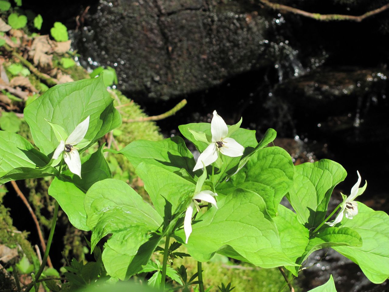
White Trillium
The highlight of our hike came as we were taking a break just before crossing the foot bridge over Pretty Hollow Creek at the junction with that trail.   As we were munching our snacks and talking, Gene and Sharon suddenly noticed a river otter on the opposite bank.  I saw him just as he ran behind a rock and into the bushes.  He then returned to the creek and, hugging the opposite bank from where we were sitting, made his way upstream.  There are river otters in the park, obviously, but they are rarely seen and almost never seen out of the water.  Wow, that was special.

Our hike was a total of 9.8 miles.  It was a beautiful hike along rushing water for much of that distance.  It’s beautiful in the spring with the creeks full of water and the wildflowers in bloom.  It would also be a lovely hike in July when the rhododendron are in bloom.  With the elk, Jack-in-the-Pulpit, and river otter, we had a very special day.

We also saw elk grazing along the road in Cataloochee.  That was pretty nice, too.

That’s it for today.  Thanks for tagging along.

Tuesday, April 10, 2012

Grateful For Another Day

Sometimes I read a passage or hear words spoken by a friend which cause me to pause in gratitude for the abundant life I enjoy.   Between the sunsets and sunrises, there are twenty-four hours of blessings untold.


Too often we take our family, friends, health, the beauty of creation, or our freedom for granted.


So, no story today, just prayers of thanksgiving.